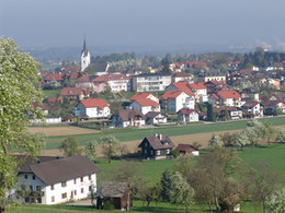
Wanderweg 1 Flachberg
Starting place: 4816 Gschwandt
Destination: 4816 Gschwandt
Beautiful pre-alpine mountain (781 m) in the immediate vicinity of Gschwandt (1 hour walk from Gschwandt), several inns along the way;
Possibility to continue hiking in the direction of Laudachsee and Grünberg.
Hiking trail 1:
Starting point: Gschwandt town centre - Schulleiten - Wegerer Kreuz - "Landgasthof Rablschenke" - along the Bergbauern goods road - left towards Flachberg, after approx. 600 m turn off to the "Wurzenhütte" inn - continue over the Flachberg towards "Im Holz" - back via the Flachberg goods road.
Refreshment stops:
Grafinger Inn, Gschwandt town centre
Gschwandtner Wirtshaus, centre of Gschwandt
Café Picasso, centre of Gschwandt
Country inn Rablschenke, Rabesberg
Wurzenhütte inn, Flachberg
Franzl im Holz inn, "Im Holz"
Silberfuchs inn, "Im Holz"
- Suitable for groups
- Suitable for schools
- Suitable for kids (all ages)
- Summer
Please get in touch for more information.
4816 Gschwandt
Phone +43 7612 64305
E-Mail info@traunsee.at
Web www.traunsee.at/gschwandt
http://www.traunsee.at/gschwandt
http://www.traunsee.at/gschwandt
http://www.traunsee.at/gschwandt


