Koppenvalley Trail

  • pets allowed
  • All weather
  • Suitable for families
  • Suitable for kids (all ages)

 Interactive elevation profile

Download GPS data
Create PDF

Tour-Details

Starting place: 8990 Bad Aussee
Destination: 4831 Obertraun

duration: 2h 37m
length: 8,8 km
Altitude difference (uphill): 260m
Altitude difference (downhill): 159m

Lowest point: 535m
Highest point: 685m
difficulty: easy
condition: easy
panoramic view: Individual Views

Paths covering:
Asphalt, Path / trail, Gravel, Street, Hiking trail

powered by TOURDATA

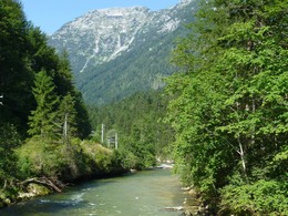
The 10km long trail leads from Bad Aussee to Obertraun through the romantic Koppen valley. Total walking time is around 3 hours. You will need sturdy walking shoes. There is an opportunity to stop off for refreshments in the Koppental valley.


Hiking suggestion:

Travel to Bad Aussee by train from either the "Obertraun Koppenbruellerhoehle" stop or the "Dachstein Hoehlen" railway station. Here we join a forest track which runs adjacent to the River Traun and the railway line. This brings us after about 1.8km to the so-called "Exit" where we approach the neighbourhood of Sarstein. To do this we need to cross the Traun and taking the gently ascending path. In Sarstein itself there are 2 places where you can buy refreshments.


After a short stretch through this romantic part of Aussee we reach a forest track. Here we make our way up to a mountain hut (the "Vogelhuette") and now and again we get a lovely view of the Krippenstein. The hut provides shelter when necessary. At this point we have already completed half of the walk. From here we bear left and walk down towards the Traun again. We cross the river via a newly built swing bridge. After 300m we pass the "Schutzhütte Koppental".


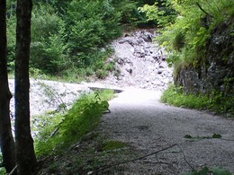
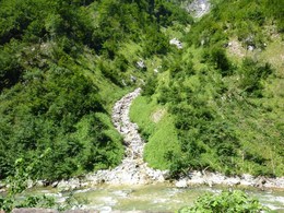
What now lies before us is 3.5 km of what is the most wildly romantic part of this new trail. This has been built on the old railway embankment which runs alongside the babbling Traun. The embankment was washed away by flooding in 1897 and then built up subsequently. We pass through the old railway tunnel which was the only defence against these water torrents and arrive, through a small detour, at the rugged Koppenbrüller Cave. These limestone, water-bearing caves with stalactites and stalagmites are open from the end of April to the end of September. There are guided tours daily from 10am to 4pm.


Now we are only 10 minutes' walk from the end of the actual Koppental trail, but there is an opportunity to take a diversion to the idyllically situated Lake Koppenwinkl and then to the Koppenwinkalm (mountain pasture). This is a round trip of around half an hour. The usual route (about 3,5 km long), however, takes us back to our starting point (Obertraun Dachsteinhoehlen station).


For those who wish to extend this comfortable, half day walking tour a little further there it is possible to follow the well-known "East bank hiking trail", 10 km trail along the eastern shore of Lake Hallstatt to Steeg. 


Order Hiking- and Mountain Biking Maps...

Mountain rescue: 140


Starting point: railway station Bad Aussee
Destination: railway station „Obertraun-Koppenbrüllerhöhle“ or parking area at the inn "Koppenrast"

further information:
  • Board possible

Accessibility / arrival

by car
from Salzburg:
Federal road B158 direction Bad Ischl
in Bad Ischl driveway onto Salzkammergut Straße B145 in direction to Bad Goisern, Hallstatt and Obertraun

from Linz:
A1 motorway exit Regau on Salzkammergut Straße B145 direction Gmunden, Bad Goisern, Hallstatt and Obertraun

from Graz:
A9 motorway exit Liezen on B320
in Trautenfels turn onto Salzkammergut Straße B145 via Bad Aussee to Obertraun

from Villach:
A10 Tauernautobahn to exit "Eben im Pongau", from there via Annaberg, Gosau and Hallstatt to Obertraun

by bus:
get off at the bus station “Obertraun Bahnhof/Feriendorf"

by train:
from Linz/Salzburg to Attnang-Puchheim, change to train to Stainach-Irdning
or from Stainach-Irdning Zug direction Attnang-Puchheim
get off at train station "Obertraun-Dachsteinhöhlen"

Travelling by public transport
Route planner for independent travellers
General price information

You can use the hiking trail free of charge.


  • All weather
  • Suitable for groups
  • Suitable for schools
  • Suitable for kids (all ages)
  • Pets allowed
Most economical season
  • Spring
  • Summer
  • Autumn

Please get in touch for more information.


Koppenvalley Trail
Tourismusverband Inneres Salzkammergut
Obertraun 180
4831 Obertraun

Phone +43 5 95095 - 40
E-Mailobertraun@dachstein-salzkammergut.at
Webwww.dachstein-salzkammergut.at
http://www.dachstein-salzkammergut.at

You can also visit us on

Visit us on Facebook Visit us on Instagram Visit us on Pinterest Visit our videochannel on YouTube Wikipedia

We speak the following languages

German

 Interactive elevation profile

Download GPS data
Create PDF

Tour-Details

Starting place: 8990 Bad Aussee
Destination: 4831 Obertraun

duration: 2h 37m
length: 8,8 km
Altitude difference (uphill): 260m
Altitude difference (downhill): 159m

Lowest point: 535m
Highest point: 685m
difficulty: easy
condition: easy
panoramic view: Individual Views

Paths covering:
Asphalt, Path / trail, Gravel, Street, Hiking trail

powered by TOURDATA