Summit tour to Rote Wand
Path number: 201
Starting place: 4582 Spital am Pyhrn
Destination: 4582 Spital am Pyhrn
Stiftsplatz 1
4582 Spital am Pyhrn
4582 Spital am Pyhrn

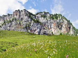
This panoramic circular hike on the Wurzeralm takes you along an exciting themed trail, past the Brunnsteinersee lake and up to the Rote Wand - with a magnificent panorama and alpine diversity.
the path winds its way up to the Rote Wand saddle. A short, steep section takes you to the summit of the Rote Wand. Here you will be rewarded for your efforts with a magnificent view of the
surrounding mountains.
From the summit, you walk downhill to the Dümlerhütte and continue uphill again via the Halssattel to the forest road. Follow this road for a while and turn left along the hiking trail, past the Filzmoosalmen and along the themed trail back to the Wurzeralm mountain station.
Path number: 201
Starting place: 4582 Spital am Pyhrn
Destination: 4582 Spital am Pyhrn
duration: 4h 55m
length: 9,8 km
Altitude difference (uphill): 823m
Altitude difference (downhill): 820m
Lowest point: 1.356m
Highest point: 1.893m
difficulty: medium
condition: medium
panoramic view: Great panorama
Paths covering:
Gravel, Hiking trail
Starting point: Wurzeralm funicular top station
Destination: Summit Rote Wand
further information:
- Possible accommodation
- Board possible
Accessibility / arrival
The starting point is the summit station of the funicular Wurzeralm in Spital am Pyhrn
Most economical season
- Spring
- Summer
- Autumn
Please get in touch for more information.
Stiftsplatz 1
4582 Spital am Pyhrn
Phone +43 7563 249
Fax machine +43 7563 249 - 20
E-Mail spital@pyhrn-priel.net
Web www.urlaubsregion-pyhrn-priel.at
https://www.urlaubsregion-pyhrn-priel.at


