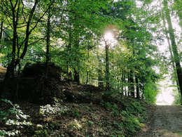
Wanderweg St. Thomas Höhenweg
Starting place: 4362 Bad Kreuzen
Destination: 4364 St. Thomas am Blasenstein
Nr. 20a
4362 Bad Kreuzen
4362 Bad Kreuzen

6 High trail to St. Thomas (8,500m)
St. Thomas am Balsenstein is known for its "Bucklwehluckn".
Today, the parish church of St Thomas, which is well worth seeing, stands on the elevated rocky plateau of the former castle "Castrum Plasenstain". In its lower church rests the mummified body of the 18th century canon Franz Xaverius Sydler de Rosenegg, popularly known as the "luftg'selchter Pfarrer".
Most economical season
- Spring
- Summer
- Autumn
Please get in touch for more information.
Nr. 20a
4362 Bad Kreuzen
mobile +43 681 20583484
E-Mail info@gsundleben.at
Web www.gsundleben.at
Web www.bad-kreuzen.at
https://www.gsundleben.at
https://www.bad-kreuzen.at
https://www.bad-kreuzen.at


