Green Trail - Let the scythes show you the way in Roßleithen
Starting place: 4575 Roßleithen
Destination: 4575 Roßleithen

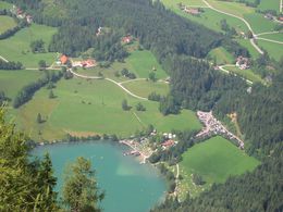
The GREEN WAY of the scythe theme trail in Roßleithen takes you past the scythe factory - Stummer Mühle - Pießling Ursprung - Gleinkersee - back to the starting point. Here you can also hike a short distance along the Benediktweg!
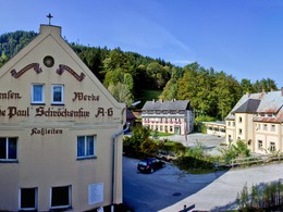
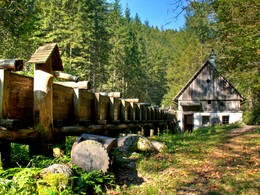
The starting point is again the hiking car park in Roßleithen: You hike past the Gasthof Sengsschmied - a "show hammer" - through the factory premises of the Schröckenfux company - largest scythe in the world - Waldhammer - "Knochentampf" - Stummermühle. A footbridge over the Pießling leads to the Gleinkersee. (But it is worth hiking to the Pießling Ursprung and back again).
A short, steep ascent leads to the Hammerschmied supply road. Now follow this uphill. Finally, a hiking trail takes you to the Gleinkersee. Here you hike back to Roßleithen on the forest hiking trail (entrance at the gravel car park). But it is also worth circling the Gleinkersee. This circular route is suitable for prams and wheelchair users. Unfortunately not the entire “Green Path”!
The "Green Path" offers many highlights: show smithy, the largest scythe in the world, Waldhammer a landmark of Roßleithen, the Stummer Mühle state exhibition, the natural spectacle Pießling Ursprung and of course the Gleinkersee.
Green scythe theme trail: circular route approx. 2 hours walking time!
Small "green scythes" show you the way!
Starting place: 4575 Roßleithen
Destination: 4575 Roßleithen
duration: 1h 36m
length: 5,3 km
Altitude difference (uphill): 153m
Altitude difference (downhill): 160m
Lowest point: 679m
Highest point: 823m
difficulty: very easy
condition: very easy
panoramic view: Individual Views
Paths covering:
Asphalt, Hiking trail
Starting point: Hiking car park in the center of Roßleithen
Destination: Hiking car park in the center of Roßleithen
further information:
- Flatly
- Board possible
Details - hiking
- themed path
Accessibility / arrival
Hiking car park in the center of Roßleithen
- Suitable for families
- Suitable for friends
- Suitable for couples
- Spring
- Summer
- Autumn
Please get in touch for more information.
4575 Roßleithen
Phone +43 7562 5266
Fax machine +43 7562 5266 - 10
E-Mail info@pyhrn-priel.net
Web www.urlaubsregion-pyhrn-priel.at
https://www.urlaubsregion-pyhrn-priel.at


