Brown Trail - Let the scythes show you the way in Roßleithen


- Flatly
Interactive elevation profile
Create PDF
Tour-Details
Starting place: 4575 Roßleithen
Destination: 4575 Roßleithen
duration: 0h 51m
length: 2,9 km
Altitude difference (uphill): 73m
Altitude difference (downhill): 79m
Lowest point: 677m
Highest point: 760m
difficulty: very easy
condition: very easy
panoramic view: Individual Views
Paths covering:
Asphalt, Gravel, Hiking trail
powered by TOURDATA
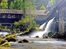
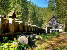
The BROWN PATH of the scythe theme trail in Roßleithen leads past the Roßleithen scythe factory to the Pießling origin and back to the starting point.
The brown scythe theme trail is initially the same as the "green" one! After crossing the bridge over the Pießling you come to the Hammerschmied goods route. Now hike back down the valley to the starting point. This path is very popular because of its special view!Brown scythe theme trail: circular route, approx. 1 hour walking time
Small "brown scythes" show them the way!
Accessibility / arrival
Hiking car park in the center of Roßleithen
Most economical season
- Spring
- Summer
- Autumn
Please get in touch for more information.
4575 Roßleithen
Phone +43 7562 5266
Fax machine +43 7562 5266 - 10
E-Mail info@pyhrn-priel.net
Web www.urlaubsregion-pyhrn-priel.at/
https://www.urlaubsregion-pyhrn-priel.at/
Interactive elevation profile
Create PDF
Tour-Details
Starting place: 4575 Roßleithen
Destination: 4575 Roßleithen
duration: 0h 51m
length: 2,9 km
Altitude difference (uphill): 73m
Altitude difference (downhill): 79m
Lowest point: 677m
Highest point: 760m
difficulty: very easy
condition: very easy
panoramic view: Individual Views
Paths covering:
Asphalt, Gravel, Hiking trail
powered by TOURDATA

