

Wurzeralm - Dümlerhütte - Wurzeralm


- Flatly
Interactive elevation profile
Create PDF
Tour-Details
Paths covering:
Description:
In order to sustainably improve the infrastructure on the mountain and prepare it for future requirements, Hinterstoder-Wurzeralm Bergbahnen AG is launching an important construction project in summer 2025: the first construction phase for snowmaking on the Frauenkarpisten slopes.
Here is all the information about the schedule, affected areas in the hiking area, technical details and contacts.
Construction period:
🗓️ From the beginning of July to the end of October 2025
⚠️ Important notice:
The Frauenkarlift will only be in operation on Saturdays and Sundays in July 2025.
Site plan Wurzeralm
Tip: For an undisturbed mountain experience, we recommend starting the themed circular trail "2 million years in 2 hours" in an anti-clockwise direction. This way, you can avoid the construction site traffic and reach the Brunnsteinersee lake and the continuing hiking trails in a relaxed manner.
Circular hike from the Wurzeralm mountain station via the Halssattel to the Dümlerhütte and back to the Rote Wand saddle and Brunnsteinersee lake to the Wurzeralm funicular mountain station.
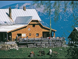
You now cross the forest road a few times before the hiking trail leads left up to the Halssattel. Here you have a wonderful panorama. Now it goes downhill and then uphill again to the Dümlerhütte. Take a break and let your gaze wander over the surrounding mountains.
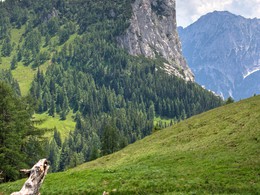
After a breather, climb northwards along the edge of the Stofferkar to the saddle of the Rote Wand. A magnificent view of the Wurzeralm, the Gesäuse and the Rottenmanner Tauern will delight many hiker's heart!
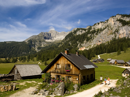
The descent is via the small, idyllic Brunnsteinersee lake. Finally, you reach hiking trail number 201, which leads back to the Wurzeralm funicular railway via the Linzerhaus.
further information:
- Flatly
- Board possible
")


")
")
")

")
")
Parking Wurzeralm base station and funicular ride up the funicular.
- Suitable for teenagers
- Suitable for seniors
- Suitable for single travelers
- Suitable for friends
- Suitable for couples
- Spring
- Summer
- Autumn
Please get in touch for more information.

Stiftsplatz 7
4582 Spital am Pyhrn
Phone +43 7563 249 - 99
Fax machine +43 7563 249 - 20
E-Mail spital@pyhrn-priel.net
Web www.urlaubsregion-pyhrn-priel.at

")
Interactive elevation profile
Create PDF
Tour-Details
Paths covering: