Polsterlucken Circular Trail (Circular Hiking World Hinterstoder)
Starting place: 4573 Hinterstoder
Destination: 4573 Hinterstoder
Hinterstoder 38
4573 Hinterstoder
4573 Hinterstoder

The most popular hiking path of the Stoder Valley starts from the parking area at the Johannishof farm, which is situated approx. 1,5 km after the village centre.
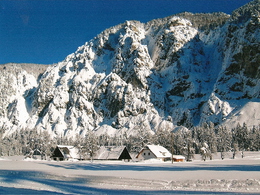
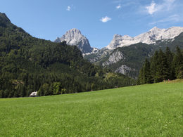
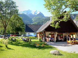
Cross the river Steyr, pass the Johannishof farm and continue along the path to the most beautiful spot with picture post card view – the Schiederweiher Pond surrounded by the most prominent peaks of the Tote Gebirge mountain range (Great Priel, Spitzmauer…) Continue towards the Polsterlucke (the term „Lucke“ is generally used in this area to describe caves) until you reach a farmhouse (refreshment stop Polsterstüberl) situated in the centre of lush meadows and surrounded by mountain peaks. Follow the gravel road in a south-easterly direction, pass the Klinsergut farm with its game feeding points and turn to your left to get back to the Schiederweiher pond and the Johannishof farm. Starting place: 4573 Hinterstoder
Destination: 4573 Hinterstoder
duration: 2h 0m
length: 5,2 km
Altitude difference (uphill): 258m
Altitude difference (downhill): 258m
Lowest point: 609m
Highest point: 727m
difficulty: easy
condition: easy
panoramic view: Great panorama
Paths covering:
Gravel, Hiking trail
Starting point: Parking from the bus stop at Johannishof, about 1.5 kilometers from the village center Hinterstoder away.
Destination: Parking from the bus stop at Johannishof, about 1.5 kilometers from the village center Hinterstoder away.
further information:
- Flatly
- Board possible
Details - hiking
- cleared winter hiking path
Accessibility / arrival
On the Stodertaler country road you drive to the center of Hinterstoder 1.5 km to the parking Schiederweiher (surcharge)
Parking- Parking space: 100
to 2 hours € 2.00 1 day € 3.00 2 to 7 days € 5.00 Annual ticket € 20.00
- Suitable for kids (all ages)
- Suitable for pushchairs
- Spring
- Summer
- Autumn
- Early winter
- Deep winter
Please get in touch for more information.
Hinterstoder 38
4573 Hinterstoder
Phone +43 7564 5263 - 99
Fax machine +43 7564 5263 - 30
E-Mail hinterstoder@pyhrn-priel.net
Web www.urlaubsregion-pyhrn-priel.at
https://www.urlaubsregion-pyhrn-priel.at


