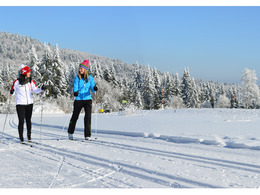
Höhenloipe Schöferhof
Path number: 28
Starting place: 4293 Gutau
Destination: 4293 Gutau
Not in operation
Cross-country skiing experience in the Mühlviertler Alm Freistadt region.
The start and finish of the Gutau cross-country ski trail is at the Mayrhö car park in Kefermarkterstraße. The fog stays in the valley when you do your laps on the Schöferhof high-altitude trail. The start is at the cross-country car park next to the Schöferhof goods road. The short circuit can be completed in half an hour, for the long circuit you should allow around 1.5 hours.
Path number: 28
Starting place: 4293 Gutau
Destination: 4293 Gutau
duration: 1h 0m
length: 5,0 km
Altitude difference (uphill): 72m
Altitude difference (downhill): 70m
Lowest point: 631m
Highest point: 661m
difficulty: easy
condition: easy
panoramic view: Some Views
Paths covering:
snow
Starting point: Car park Güterweg Schöferhof
Destination: Car park Güterweg Schöferhof
further information:
- culinary interesting
- Flatly
- Possible accommodation
- Board possible
Details - Trail
- Nordic skiing facilities: Marked Nordic skiing run
- Type of Nordic skiing run: Classic style
- free
In suitable snow conditions.
Accessibility / arrival
Motorway Linz - A7 - to Unterweitersdorf - Pregarten - Selker - Gutau
Summerauerbahn to Pregarten station (6 km) or Kefermarkt (5 km) to Gutau
Linz/Hörsching
Starting/ending points: The start of the circular trail is possible in the village centre (at the Telekom building), or on the so-called "Moarhöhe" at the small cross-country trail car park next to the Schöferhof estate road.
Cross-country trail car parks: "Moarhöhe" at the small cross-country trail car park next to the Schöferhof estate road.
- Suitable for groups
- Suitable for schools
- Pets allowed
- Suitable for teenagers
- Suitable for seniors
- Suitable for single travelers
- Suitable for families
- Suitable for friends
- Suitable for couples
- Deep winter
Please get in touch for more information.
4293 Gutau
Phone +43 7942 75700
E-Mail gemeinde@gutau.ooe.gv.at
Web www.gutau.at
Web www.muehlviertel-almfreistadt.at/th…
http://www.gutau.at
https://www.muehlviertel-almfreistadt.at/themen/winter/langlaufen
https://www.muehlviertel-almfreistadt.at/themen/winter/langlaufen


