

Mönichsreith Circular Trail


- Suitable for families
- Flatly
Interactive elevation profile
Create PDF
Tour-Details
Starting place: 5360 St. Wolfgang im Salzkammergut
Destination: 5360 St. Wolfgang im Salzkammergut
duration: 0h 19m
length: 4,0 km
Altitude difference (uphill): 42m
Lowest point: 537m
Highest point: 558m
difficulty: easy
condition: easy
panoramic view: Some Views
Paths covering:
snow
powered by TOURDATA
Trail not in operation
The Mönich riding circuit in the Wolfgangtal valley offers 4 km of groomed trails in classic technique.
Trail route:From the Raudaschl farmhouse in Schwarzenbach go right (on flat terrain), then over the Schwarzenbach stream and further on flat terrain to the branch to Strobl. Here left and crossing the Schwarzenbach stream again, still on flat terrain, go around the Mönichsreither Hill back to Schwarzenbach.
In the folder Winter Hiking Trails and Cross Country Skiing you can find the according numbers.
Starting point: Raudaschl farmhouse in Schwarzenbach
Destination: Raudaschl farmhouse in Schwarzenbach
further information:
- Flatly
Details - Trail
- Nordic skiing facilities: Marked Nordic skiing run
- Type of Nordic skiing run: Classic + skating
December till February
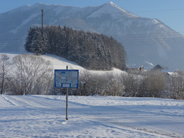
001 Einstieg und Ziel
Direction information: Departure

002 Kreuzung 5 Mönichsreithrunde

003 Abzweigung 4 Wolfgangthalloipe

004 Einstieg Schwarzenbach
Accessibility / arrival
Starting points:
Tourist Information in Schwarzenbach (P) 200 mts to trail, Bürglsteineck nort of the Achen bridge (P), Strobl bus station (P)
- Parking space: 20
General price information
free of charge
- Suitable for groups
- Suitable for families
- Suitable for friends
- Suitable for couples
- Suitable for children
- Deep winter
Please get in touch for more information.
Au 140
5360 St. Wolfgang im Salzkammergut
Phone +43 6138 8003
Fax machine +43 6138 8003 - 81
E-Mail info@wolfgangsee.at
Web wolfgangsee.salzkammergut.at
https://wolfgangsee.salzkammergut.at
Interactive elevation profile
Create PDF
Tour-Details
Starting place: 5360 St. Wolfgang im Salzkammergut
Destination: 5360 St. Wolfgang im Salzkammergut
duration: 0h 19m
length: 4,0 km
Altitude difference (uphill): 42m
Lowest point: 537m
Highest point: 558m
difficulty: easy
condition: easy
panoramic view: Some Views
Paths covering:
snow
powered by TOURDATA