Alluvial Canal bicycle route
Path number: 888 und 1023
Starting place: 94145 Haidmühle
Destination: 4170 St. Oswald bei Haslach
St. Oswald 18
4170 St. Oswald bei Haslach
4170 St. Oswald bei Haslach

Cross-border cycle tour (Germany, Czech Republic, Šumava adventure region), flat route, average gradient 0.2 %! Travel document required!
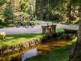
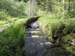
Markings: 888 in Austria, 1023 in the Czech Republic and white-blue-white tree markings.Along the Schwarzenberg alluvial canal, cyclists can learn about the history of the canal on an accompanying path.
0 km Starting point Haidmühle (DE) - border parking lot: You pass the German-Czech border. The route now climbs approx. 500 m to the...
0.5 km junction "Stozeck-Schwemmkanal-Nové Údolí". Turn right towards the Schwarzenberg alluvial canal. Follow the ascending, somewhat brittle asphalt road until you reach the beginning of the alluvial canal at the...
3.8 km Rosenauer Denkmal/Lichtwasser . On the right you will see the monument erected in honor of the builder of the alluvial canal. However, you turn left towards the alluvial canal, which accompanies you to the end of the tour. You will soon pass the turn-off towards Lake Plöckenstein/Plešné jezero and later the western portal of the Štiavnica tunnel.
15.6 km Hirschbergen/Jelení Vrchy. Here you can see the exit portal of the originally 419 m long tunnel. After a short, steep descent, turn right into the canal and you will come to the...
17.6 km Rosenauer Chapel & Seebach lock. The Seebach was one of the most important tributary streams as a connecting channel to Lake Plöckenstein. Remaining on the canal, you reach the crossing at the...
21.6 km Rossbachschleuse (branch off to the border crossing 1/10 towards Holzschlag).
26 km Hefenkriegbach-Riese. Here you will see the sculpture "der Wächter", which was erected as part of the "Kulturachse Schwemmkanal". You will come across works of art like this many times.
32.5 km Glöckelberg/Zadní Zvonková. Only the rebuilt church remains of the former village. You can learn more about the history of the village in the small museum (or at www.gloeckelberg.at). Cross the asphalt road that leads towards the Schöneben border crossing and continue along the beautiful dirt road past the Rotbach lock (border) to...
34.6 km Sonnenwald. Follow the canal. You will pass the Landsknechtin lock and the sculpture "The 7 Ravens" and shortly afterwards reach the...
41.8 km Schrollenbach lock. After 500 m you cross the Krumauer Straße (leads to Oberhaag and Aigen-Schlägl) and continue along the beautiful forest road to the...
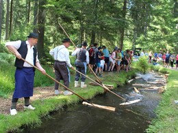
46.1 km Iglbach/Doppelbrücke. There are always show floats here in summer (program at www.muehlviertel.at). You pass the Austrian-Czech border.
47.7 km At Rosenhügel/Koranda you cross the transcontinental watershed. A sculpture illustrates this natural border. Continue to the right and take a somewhat bumpy country lane to the...
50.4 km St. Oswald border crossing. The sculpture "Connect it" symbolizes the rapprochement between the two countries. Now it's a brisk downhill ride to...
51.8 km St. Oswald near Haslach.
Bike transfer:
Bus travel Venzl in Klaffer am Hochficht
Cab company Eder in Rohrbach-Berg
Request the bike map here for EUR 3.00 or the free folder about the Schwarzenberg Schwemmkanal.
You can use the free outdooractive app to navigate the route.
Path number: 888 und 1023
Starting place: 94145 Haidmühle
Destination: 4170 St. Oswald bei Haslach
duration: 5h 0m
length: 51,8 km
Altitude difference (uphill): 372m
Altitude difference (downhill): 643m
Lowest point: 661m
Highest point: 947m
difficulty: easy
condition: easy
panoramic view: Some Views
Paths covering:
Asphalt, Gravel
Starting point: Haidmühle in Germany!
Destination: St. Oswald town square.
further information:
- culinary interesting
- Possible accommodation
- Board possible
Most economical season
- Spring
- Summer
- Autumn
Please get in touch for more information.
St. Oswald 18
4170 St. Oswald bei Haslach
Phone +43 5 07263 - 200
E-Mail boehmerwald@muehlviertel.at
Web www.muehlviertel.at/
https://www.muehlviertel.at/
You can also visit us on
Facebook Instagram YouTube


