© Foto: Oberösterreich Tourismus GmbH/Robert Maybach: Gesellige Runde am Wolfgangsee
Gruppe junger Menschen auf einem Steg am Wolfgangsee

Mostkulturweg

  • Suitable for families
  • culinary interesting
  • Flatly

 Interactive elevation profile

Download GPS data
Create PDF

Tour-Details

Path number: 25
Starting place: 4076 St. Marienkirchen an der Polsenz
Destination: 4076 St. Marienkirchen an der Polsenz

duration: 1h 16m
length: 5,0 km
Altitude difference (uphill): 32m
Altitude difference (downhill): 37m

Lowest point: 310m
Highest point: 363m
difficulty: very easy
condition: easy
panoramic view: Some Views

Paths covering:
Asphalt, Gravel, Hiking trail

powered by TOURDATA

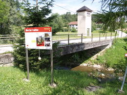
St. Marienkirchen market square (cider museum, Mostspitz) - Polsenzufer - Aibachsteg - Sturm rest area - Doppl - herb garden - fruit educational garden - St. Marienkirchen
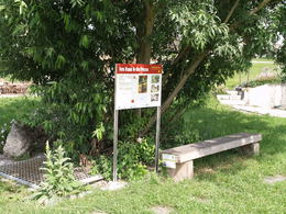
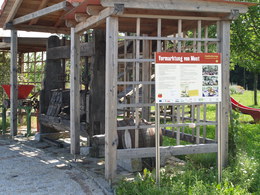
The "Cider Culture Trail" in the Obst-Hügel-Land Nature Park is dedicated to many facets of the Upper Austrian regional beverage cider: from the cider fruit trees that characterise the landscape, to the orchard harvest and processing, to modern cellar technology in cider production. The history and culture of cider and the contemporary marketing of this beverage are also covered on this themed trail. The cider culture trail was designed in 2011 by students of the HLFS Elmberg with the aim of linking existing facilities such as the cider museum, the Mostspitz and the St. Marienkirchen fruit educational garden.

further information:
  • culinary interesting
  • Flatly

Details - hiking
  • themed path
Travelling by public transport
Route planner for independent travellers
Most economical season
  • Spring
  • Summer
  • Autumn

Please get in touch for more information.


Mostkulturweg
Naturpark Obst-Hügel-Land
Kirchenplatz 1
4076 St. Marienkirchen an der Polsenz

Phone +43 7249 47112 - 25
E-Mail info@obsthuegelland.at
Web www.obsthuegelland.at
http://www.obsthuegelland.at

We speak the following languages

German

 Interactive elevation profile

Download GPS data
Create PDF

Tour-Details

Path number: 25
Starting place: 4076 St. Marienkirchen an der Polsenz
Destination: 4076 St. Marienkirchen an der Polsenz

duration: 1h 16m
length: 5,0 km
Altitude difference (uphill): 32m
Altitude difference (downhill): 37m

Lowest point: 310m
Highest point: 363m
difficulty: very easy
condition: easy
panoramic view: Some Views

Paths covering:
Asphalt, Gravel, Hiking trail

powered by TOURDATA