Vogelkundeweg
4293 Gutau

The showroom at the start of the Gutau ornithological trail shows the different habitats and the typical bird species.
Information stations, a nature playground and a beautiful view at the end characterise the ornithological trail, which is ideal for walking with children. The start and finish is the interesting showroom opposite the Dyer Museum. From the car park, the trail climbs up Birkenstraße until it enters the "fairytale forest". Via a total of seven information stations, rest areas and playgrounds, the ornithological trail finally reaches the Hainberg, where a beautiful view opens up over the village to the south. The way back leads quickly downhill via a small settlement to the starting point.
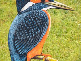
Following the kingfisher symbol, you finally head out into nature - initially slightly uphill via Birkenstraße. The second information station, "Sprüche klopfen", is already waiting here. After crossing the Marreith goods road, walkers enter the forest via a short meadow path, where simple questions have to be answered at the third information station "weich uns spitz" (soft and sharp). The fourth station, "Birdsong", is characterised by a giant listening tube that makes you aware of the diverse sounds of the forest. The fifth station is all about "bird dwellings". A climbing wall designed as a bird's nest challenges your dexterity and the house slide takes you quickly down to the rest area.
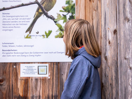
The sixth information station is dedicated to birds in the ecosystem. The forest path then climbs slightly again and hikers head towards the seventh information station "Bird species" on the meadow path, which leads out of the shady forest across sun-drenched meadows onto the Hainberg. The "View into the future" at the eighth information station is more than just a symbol. The view sweeps far over the rooftops of Gutau - from new housing estates to the historic private Weinberg Castle and beyond to the Alps. With the Hainberg forest to the right, the path now descends gently back to the starting point. A final turn to the left at the Höller-Stadel leads to a small residential road that descends steeply towards the Dyers' Museum.
Worth seeing/worth knowing:
Giant bird's nest, accessible nesting box, listening tube (like a funnel, the listening tube collects the sounds of the forest), snack gardens.
Paths covering:
further information:
- Flatly
- Possible accommodation
- Experience of nature
- Board possible
Details - hiking
- themed path
- educational path
by car:
Linz motorway - A7 - to Unterweitersdorf - Pregarten - Selker - Gutau
by train:
Summerauerbahn to Pregarten station (6 km) or Kefermarkt (5 km) to Gutau
free of charge
Guided tours are offered: Group rate (approx. 10 people) € 2,-/child, € 3,-/adult Contact and booking: Gutau municipal office +43 (0) 7946/6255, Emma Resch +43 (0) 7946/6442
- All weather
- Suitable for groups
- Suitable for schools
- Suitable for kids (all ages)
- Suitable for pushchairs
- Pets allowed
- Suitable for families
- Spring
- Summer
- Autumn
- Early winter
Please get in touch for more information.
St. Oswalderstraße 2
4293 Gutau
Phone +43 7946 6255
E-Mail gemeinde@gutau.ooe.gv.at
Web www.gutau.at/tourismus-freizeit


