Obst-Hügel-Land Radweg
Path number: N1
Starting place: 4076 St. Marienkirchen an der Polsenz
Destination: 4076 St. Marienkirchen an der Polsenz
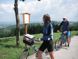
The 37 km long Obst-Hügel-Land cycle path (N1) connects the two nature park communities of Scharten and St. Marienkirchen/Polsenz.
The circular route leads through the hilly nature park area with marvellous views, but also a few climbs and descents. The cycle path is best ridden on a leisure bike (note: approx. 1km gravel path) and runs almost entirely along local roads with little traffic.Numerous inns and cider taverns await you on your tour. You can also start your cycle tour here.
- Suitable for kids (10 - 14 Year)
- Suitable for families
- Spring
- Summer
- Autumn
Please get in touch for more information.
4076 St. Marienkirchen an der Polsenz
Phone +43 7249 47112 - 25
E-Mail info@obsthuegelland.at
Web www.obsthuegelland.at
http://www.obsthuegelland.at


