

Druid path with Lasberg panoramic view


- All weather
- Suitable for families
Interactive elevation profile
Create PDF
Tour-Details
Starting place: 4291 Lasberg
Destination: 4291 Lasberg
duration: 0h 38m
length: 2,0 km
Altitude difference (uphill): 98m
Altitude difference (downhill): 14m
Lowest point: 560m
Highest point: 649m
difficulty: easy
condition: easy
panoramic view: Great panorama
Paths covering:
Asphalt, Hiking trail
powered by TOURDATA
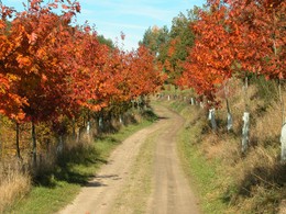
On one of the most beautiful sections of the Marktkulturwanderweg trail, with wonderful views of the rolling hills of the Mühlviertel and the Alpine arc, 30 educational boards have been erected about the folk healing uses of fruits, leaves and bark from local trees and shrubs. The Celtic druids had a wealth of knowledge about the healing powers of plants, hence the name "Druid Trail".
A detour to the Lasberg panoramic view at the Spiralschmiede forge is definitely worthwhile in good weather. What's more, both paths are flat, short and only 2 km from Lasberg market town. The oak was revered by the Druids as a special tree. They utilised the knowledge of the plant's healing powers.
Hiking map and themed trail folder available at the market town office.
- All weather
- Suitable for groups
- Suitable for schools
- Spring
- Summer
- Autumn
Please get in touch for more information.

Markt 26
4291 Lasberg
Phone +43 7947 7255 - 13
E-Mail tourismuskern@lasberg.at
Web www.lasberg.at
Web www.muehlviertel-urlaub.at/wandern
http://www.lasberg.at
http://www.muehlviertel-urlaub.at/wandern
http://www.muehlviertel-urlaub.at/wandern
Interactive elevation profile
Create PDF
Tour-Details
Starting place: 4291 Lasberg
Destination: 4291 Lasberg
duration: 0h 38m
length: 2,0 km
Altitude difference (uphill): 98m
Altitude difference (downhill): 14m
Lowest point: 560m
Highest point: 649m
difficulty: easy
condition: easy
panoramic view: Great panorama
Paths covering:
Asphalt, Hiking trail
powered by TOURDATA