

Mühlenwanderweg


Interactive elevation profile
Create PDF
Tour-Details
Path number: D2
Starting place: 4371 Dimbach
Destination: 4371 Dimbach
duration: 3h 34m
length: 14,0 km
Altitude difference (uphill): 278m
Altitude difference (downhill): 276m
Lowest point: 535m
Highest point: 685m
difficulty: medium
condition: easy
panoramic view: Individual Views
Paths covering:
Asphalt, Hiking trail
powered by TOURDATA
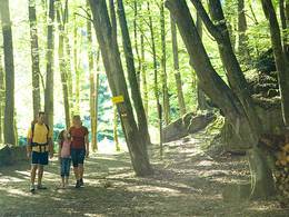
The road leads out of town in the direction of Grein,
turn right into the Angerweg housing estate road
past the sports field to the Riegelhof municipal road.
The route then leads along wonderful forest and meadow paths
via the Auger, Großsteiner, Zehetner and Reithner
into the romantic Gießenbach valley. The hike continues
continues via the Wiesegger into the valley of the
Blümelbach stream via the Königsmühle mill to below the
Holzmühle, where the path leads back to Dimbach.
leads back to Dimbach.
Most economical season
- Spring
- Summer
- Autumn
Please get in touch for more information.
Phone +43 7260 7507 - 0
E-Mail marktgemeinde@dimbach.ooe.gv.at
Web www.dimbach.at
http://www.dimbach.at
Interactive elevation profile
Create PDF
Tour-Details
Path number: D2
Starting place: 4371 Dimbach
Destination: 4371 Dimbach
duration: 3h 34m
length: 14,0 km
Altitude difference (uphill): 278m
Altitude difference (downhill): 276m
Lowest point: 535m
Highest point: 685m
difficulty: medium
condition: easy
panoramic view: Individual Views
Paths covering:
Asphalt, Hiking trail
powered by TOURDATA