

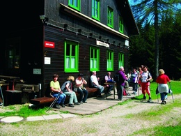
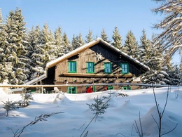
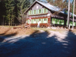
Amstettner Hütte (via Forsteralm)


Interactive elevation profile
Create PDF
Tour-Details
Path number: E01
Starting place: 3334 Gaflenz
Destination: 3340 Waidhofen an der Ybbs
duration: 0h 30m
length: 1,0 km
Altitude difference (uphill): 201m
Lowest point: 721m
Highest point: 921m
difficulty: easy
condition: easy
panoramic view: Some Views
Paths covering:
Asphalt, Path / trail, Gravel, Hiking trail, Other
powered by TOURDATA
Short description:
Short hike from parking 2 of the Forsteralm to the Amstettner Hut
Short hike from parking 2 of the Forsteralm to the Amstettner Hut
Recommended season:
- January
- February
- March
- April
- May
- June
- July
- August
- September
- October
- November
- December
The trail leads steadily uphill from car park 2 of the Forsteralm to the Amstettner Hütte.
Trail number: E01
Alternative:
Circular trail from Gaflenz via Güterweg and Bürgertal to Amstettner Hütte and via Oberland back to Gaflenz.
Directions:
The trail leads steadily uphill from parking 2 of the Forsteralm to the Amstettner Hütte.
Variant:
Circular trail from Gaflenz via Güterweg and Bürgertal to Amstettner Hütte and via Oberland back to Gaflenz.
Starting point: Gaflenz/parking 2 of the Forsteralm
Destination: Amstettner Hütte
Accessibility / arrival
Parking
Gaflenz/parking 2 of the Forsteralm Parking
Public Transit
The Ennstalbahn runs between Linz and Weißenbach-St. Gallen.
Railway Stations are located in Steyr, Garsten, Lahrndorf, Dürnbach, Ternberg, Trattenbach, Losenstein, Reichraming, Großraming, Gaflenz, Weyer, Küpfern, Kastenreith, Kleinreifling and Weißenbach-St. Gallen.
Parking
Gaflenz/parking 2 of the Forsteralm Parking
- Parking space: 1
- Suitable for groups
- Suitable for seniors
- Suitable for single travelers
- Suitable for friends
- Suitable for couples
- Suitable for children
- Spring
- Summer
- Autumn
- Early winter
- Deep winter
Please get in touch for more information.
Stadtplatz 27
4400 Steyr
Phone +43 7252 53229 - 0
E-Mail reichraming@steyr-nationalpark.at
Web www.steyr-nationalpark.at/
https://www.steyr-nationalpark.at/
You can also visit us on
Visit us on Facebook")
")
Interactive elevation profile
Create PDF
Tour-Details
Path number: E01
Starting place: 3334 Gaflenz
Destination: 3340 Waidhofen an der Ybbs
duration: 0h 30m
length: 1,0 km
Altitude difference (uphill): 201m
Lowest point: 721m
Highest point: 921m
difficulty: easy
condition: easy
panoramic view: Some Views
Paths covering:
Asphalt, Path / trail, Gravel, Hiking trail, Other
powered by TOURDATA