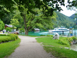
Plomberg-Runde
Starting place: 5340 St. Gilgen
Destination: 5340 St. Gilgen
A magnificently beautiful circular run.
Start and finish at the Fischerwirt Schiffsstation (jetty) – church – town hall – Steinklüftstraße (road) – across the main road – Obenauer Straße (road) – past the Plomberghof (farmstead) – after 400mt, right to the Buchberg (farmstead) – down to the main road – cross over – at Europakloster Gut Aich (monastery) – go right along Fürbergstraße (road) – to lake Wolfgang – right, along the shore to Brunnwinkl – Mondseer Straße (road) to the Minigolfplatz (crazy golf) – left on the Lienbacherweg (path) back to the starting point.
Distance: 8,5 km
Elevation Difference: 165 m
Gravel-Course: 5,5 km
Tarmac-Course: 3,0 km
Time: 30 to 60 min
Nordic Walking: 110 min
Accessibility / arrival
in the center of the village St. Gilgen, near the jetty.
Parking- Parking space: 20
yes
- All weather
- Suitable for schools
- Suitable for kids (10 - 14 Year)
- Suitable for single travelers
- Suitable for friends
- Suitable for couples
- Spring
- Summer
- Autumn
Please get in touch for more information.
Au 140
5360 St. Wolfgang im Salzkammergut
Phone +43 6138 8003
E-Mail info@wolfgangsee.at
Web www.wolfgangsee.at
https://www.wolfgangsee.at


