Ruinen-Radroute Nr. 956
Path number: 956
Starting place: 4274 Schönau im Mühlkreis
Destination: 4282 Pierbach
Schulstraße 1
4274 Schönau im Mühlkreis
4274 Schönau im Mühlkreis

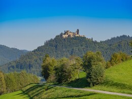
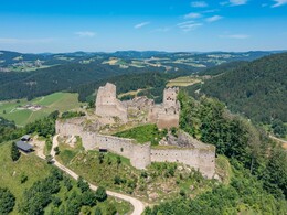
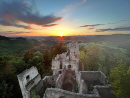
The cycle route starts in Riedhammer Güterweg Prandegg and leads via the ruins of Prandegg, Peherssdorf, Schönau im Mühlkreis and ends at the ruins of Ruttenstein.
Path number: 956
Starting place: 4274 Schönau im Mühlkreis
Destination: 4282 Pierbach
duration: 1h 25m
length: 15,8 km
Altitude difference (uphill): 431m
Altitude difference (downhill): 479m
Lowest point: 488m
Highest point: 763m
difficulty: medium
condition: difficult
panoramic view: Some Views
Paths covering:
Hiking trail
Destination: Ruttenstein ruin
further information:
Accessibility / arrival
Coming from Linz by car: via A7 and Königswiesener Str./B124
40 min., 43.1 km
Most economical season
- Spring
- Summer
- Autumn
Please get in touch for more information.
Schulstraße 1
4274 Schönau im Mühlkreis
Phone +43 5 07263 - 301
E-Mail badzell@muehlviertel.at
Web www.muehlviertel.at
Web www.schoenau-im.at/
https://www.muehlviertel.at
https://www.schoenau-im.at/
https://www.schoenau-im.at/


