

Themenweg 5: NaturKulturWeg


- Flatly
Interactive elevation profile
Create PDF
Tour-Details
Starting place: 4210 Gallneukirchen
Destination: 4210 Gallneukirchen
duration: 1h 50m
length: 6,7 km
Altitude difference (uphill): 110m
Altitude difference (downhill): 110m
Lowest point: 329m
Highest point: 429m
difficulty: easy
condition: easy
panoramic view: Some Views
Paths covering:
Asphalt, Hiking trail
powered by TOURDATA
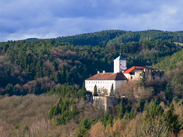
"NaturKulturWeg Gallneukirchen" is an approx. 5 km long circular trail with a high natural and cultural experience value.
The starting point is in front of the town hall and after a short walk through the parks and green spaces in the centre of Gallneukirchen, the forest path leads you to the "Gallinger Höhenweg", where you can enjoy the wonderful panorama over the Gallneukirchen basin.
Continue along the old tracks of the horse-drawn railway, past the former "Waldheimat" station building and finally along our "lifeline" Gusen.
Information boards along the way provide interesting facts about natural and cultural topics and there is a shorter, barrier-free circular route for people with disabilities and a longer circular cycle route for cyclists.

Most economical season
- Spring
- Summer
- Autumn
Please get in touch for more information.
Reichenauer Straße 1
4210 Gallneukirchen
Phone +43 7235 63155
E-Mail stadtgemeinde@gallneukirchen.ooe.gv.at
Web www.gallneukirchen.at/STADT_er_lebe…
Web www.muehlviertel-urlaub.at/wandern
https://www.gallneukirchen.at/STADT_er_leben/Tourismus_Freizeit/Wanderwege
http://www.muehlviertel-urlaub.at/wandern
http://www.muehlviertel-urlaub.at/wandern
Interactive elevation profile
Create PDF
Tour-Details
Starting place: 4210 Gallneukirchen
Destination: 4210 Gallneukirchen
duration: 1h 50m
length: 6,7 km
Altitude difference (uphill): 110m
Altitude difference (downhill): 110m
Lowest point: 329m
Highest point: 429m
difficulty: easy
condition: easy
panoramic view: Some Views
Paths covering:
Asphalt, Hiking trail
powered by TOURDATA