

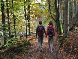
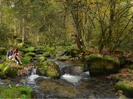
Freiwaldrundweg


- Suitable for families
- Flatly
Interactive elevation profile
Create PDF
Tour-Details
Path number: FR 11
Starting place: 4240 Freistadt
Destination: 4240 Freistadt
duration: 4h 51m
length: 16,1 km
Altitude difference (uphill): 440m
Altitude difference (downhill): 440m
Lowest point: 553m
Highest point: 849m
difficulty: medium
condition: medium
panoramic view: Individual Views
Paths covering:
Hiking trail
powered by TOURDATA
This beautifully laid out hiking trail was created years ago after a fire brigade hiking day organised by the municipality of Grünbach. The hikers were so enthusiastic afterwards that the route was then created as a new hiking trail. The route leads northwards through the Thurytal valley to Grünbach and through the Zelletau valley back to the brewing and cultural town of Freistadt.
Parking
- Parking space: 20
- Bus parking space: 2
- Suitable for groups
- Suitable for schools
- Suitable for single travelers
- Suitable for couples
- Spring
- Summer
- Autumn
Please get in touch for more information.
Hauptplatz 1
4240 Freistadt
Phone +43 664 8325756
E-Mail office@freistadt.city
Web freistadt.city
Web www.muehlviertel-urlaub.at/wandern
https://freistadt.city
http://www.muehlviertel-urlaub.at/wandern
http://www.muehlviertel-urlaub.at/wandern
Interactive elevation profile
Create PDF
Tour-Details
Path number: FR 11
Starting place: 4240 Freistadt
Destination: 4240 Freistadt
duration: 4h 51m
length: 16,1 km
Altitude difference (uphill): 440m
Altitude difference (downhill): 440m
Lowest point: 553m
Highest point: 849m
difficulty: medium
condition: medium
panoramic view: Individual Views
Paths covering:
Hiking trail
powered by TOURDATA