

Über die Braunberghütte auf den Buchberg


- Suitable for families
Interactive elevation profile
Create PDF
Tour-Details
Path number: IVV
Starting place: 4291 Lasberg
Destination: 4291 Lasberg
duration: 4h 57m
length: 15,0 km
Altitude difference (uphill): 601m
Altitude difference (downhill): 603m
Lowest point: 501m
Highest point: 896m
difficulty: easy
condition: easy
panoramic view: Individual Views
Paths covering:
Hiking trail
powered by TOURDATA
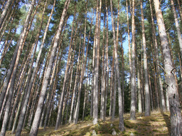
From the inn, the hike follows the meditation trail through the beautiful Feistritz valley, along the reservoir to the Hammerschmiede forge. The hike continues in the direction of Lasberg. Following the markings towards Braunberg, after approx. 1.5 km the trail climbs slightly to the Braunberg Alpine Club hut.
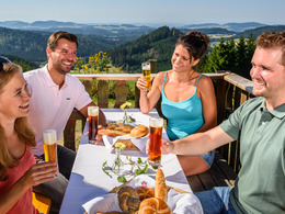
After a little refreshment, the hike continues along the "Buchberg" markings. Via the "Braunluka" to the Hiaslbauer farm. Continue for approx. 1 km on the Grensberg farm track. After crossing the Roßtauscherbachl, the trail climbs again slightly to the Grillparzer farm. After crossing Pabener-Straße, the route climbs up to Buchberg. Once you reach the Buchberg, the "Hoh Haus am Buchberg" awaits you with a moss-covered snail that invites hikers to linger and also serves as a shelter. The 10.5 metre high viewing tower offers a fantastic view over the Mühlviertel and on a clear day you can see the entire Alpine chain. The trail continues through the forest to Haus Tröbinger, where the hike continues on the goods road to the left. After approx. 300 metres, the Kernland Museum is on the left. Continue along a meadow path (hiking trails 7, 8, 5, 9) to the village of Siegelsdorf. From there it is approx. 10 minutes back to the Gasthof Zur Haltestelle.
After a little refreshment, the hike continues along the "Buchberg" markings. Via the "Braunluka" to the Hiaslbauer farm. Continue for approx. 1 km on the Grensberg farm track. After crossing the Roßtauscherbachl, the trail climbs again slightly to the Grillparzer farm. After crossing Pabener-Straße, the route climbs up to Buchberg. Once you reach the Buchberg, the "Hoh Haus am Buchberg" awaits you with a moss-covered snail that invites hikers to linger and also serves as a shelter. The 10.5 metre high viewing tower offers a fantastic view over the Mühlviertel and on a clear day you can see the entire Alpine chain. The trail continues through the forest to Haus Tröbinger, where the hike continues on the goods road to the left. After approx. 300 metres, the Kernland Museum is on the left. Continue along a meadow path (hiking trails 7, 8, 5, 9) to the village of Siegelsdorf. From there it is approx. 10 minutes back to the Gasthof Zur Haltestelle.
- Suitable for groups
- Suitable for teenagers
- Suitable for seniors
- Suitable for single travelers
- Suitable for friends
- Suitable for couples
- Spring
- Summer
- Autumn
- Early winter
Please get in touch for more information.
Markt 26
4291 Lasberg
Phone +43 7947 7255 - 13
E-Mail tourismuskern@lasberg.at
Web www.lasberg.at
Web www.muehlviertel-urlaub.at/wandern
https://www.lasberg.at
https://www.muehlviertel-urlaub.at/wandern
https://www.muehlviertel-urlaub.at/wandern
Interactive elevation profile
Create PDF
Tour-Details
Path number: IVV
Starting place: 4291 Lasberg
Destination: 4291 Lasberg
duration: 4h 57m
length: 15,0 km
Altitude difference (uphill): 601m
Altitude difference (downhill): 603m
Lowest point: 501m
Highest point: 896m
difficulty: easy
condition: easy
panoramic view: Individual Views
Paths covering:
Hiking trail
powered by TOURDATA