Baumschlagerreith - Steyr origin
Starting place: 4573 Hinterstoder
Destination: 4573 Hinterstoder

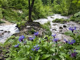
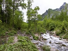
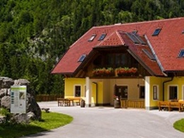
From Almgasthof Baumschlagerreith you can walk comfortably to the Steyr-Ursprung.
The hike is ideal for families or in summer on hot days!
Starting place: 4573 Hinterstoder
Destination: 4573 Hinterstoder
duration: 0h 11m
length: 0,7 km
Altitude difference (uphill): 17m
Lowest point: 707m
Highest point: 732m
difficulty: easy
condition: very easy
panoramic view: Some Views
Paths covering:
Gravel, Other
Starting point: Baumschlagerreith Hinterstoder
Destination: Steyr origin
Accessibility / arrival
to the exit St. Pankraz / Hinterstoder; Turn left onto the B 138 towards Hinterstoder; In the Flusensenke turn towards Hinterstoder / Stodertal; Follow the Landesstraße, through Hinterstoder through the valley; Follow the signs to Gasthaus Baumschlagerreith; Asphalt road to the inn.
- Suitable for groups
- Suitable for schools
- Suitable for kids (all ages)
- Suitable for teenagers
- Suitable for seniors
- Suitable for single travelers
- Suitable for families
- Suitable for friends
- Suitable for couples
- Suitable for children
- Spring
- Summer
- Autumn
Please get in touch for more information.
4573 Hinterstoder
Phone +43 7564 5263
E-Mail info@pyhrn-priel.net
Web www.urlaubsregion-pyhrn-priel.at/
https://www.urlaubsregion-pyhrn-priel.at/


