

Laufstrecke: Trodat-Steg zum Museumssteg


Interactive elevation profile
Create PDF
Tour-Details
Starting place: 4600 Wels
Destination: 4600 Wels
duration: 0h 19m
length: 2,7 km
Lowest point: 312m
Highest point: 316m
difficulty: easy
condition: easy
panoramic view: Individual Views
Paths covering:
Asphalt, Gravel
powered by TOURDATA
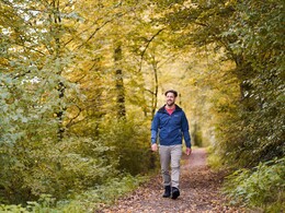
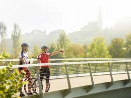
Running round the Traun. The running route leads along the Traun on both the Wels and Thalheim sides, which you cross via the Trodat footbridge in the east and the museum footbridge in the west.
The tour can be started anywhere along the Traun.
The tour can be started anywhere along the Traun.


")

")
")
")

")

")
")
")
")


")
")
")

")


")


")

")


Most economical season
- Spring
- Summer
- Autumn
Please get in touch for more information.
Stadtplatz 44
4600 Wels
Phone +43 7242 67722 - 22
E-Mail Info@wels.at
Web www.wels.at
http://www.wels.at
Interactive elevation profile
Create PDF
Tour-Details
Starting place: 4600 Wels
Destination: 4600 Wels
duration: 0h 19m
length: 2,7 km
Lowest point: 312m
Highest point: 316m
difficulty: easy
condition: easy
panoramic view: Individual Views
Paths covering:
Asphalt, Gravel
powered by TOURDATA