

Road bike tour - Neustiftrunde


- Flatly
Interactive elevation profile
Create PDF
Tour-Details
Starting place: 4462 Reichraming
Destination: 4462 Reichraming
duration: 4h 30m
length: 72,8 km
Altitude difference (uphill): 606m
Altitude difference (downhill): 606m
Lowest point: 287m
Highest point: 612m
difficulty: medium
condition: medium
panoramic view: Individual Views
Paths covering:
Asphalt, Path / trail, Gravel, Street, Hiking trail, Other
powered by TOURDATA
Short description:
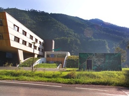
The start of this tour is at the Ennstal National Park Visitor Center - from here the route leads in the direction of Großraming. At the traffic circle, take the second exit and drive through the Neustiftgraben to Maria Neustift and continue on the Steyrerstrasse and the Ramingtalstrasse through the Ramingtal to Kleinraming and Steyr.
The start of this tour is at the Ennstal National Park Visitor Center - from here the route leads in the direction of Großraming. At the traffic circle, take the second exit and drive through the Neustiftgraben to Maria Neustift and continue on the Steyrerstrasse and the Ramingtalstrasse through the Ramingtal to Kleinraming and Steyr.
Recommended season:
- April
- May
- June
- July
- August
- September
- October
Properties:
- Loop
- Refreshment stops available
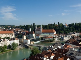
In Steyr drive a piece on the Haratzmüllerstraße, after about 1.3 km the path branches off to the right to the Enns and from there via the Bahnhofstraße to the Ennskai. Follow this road until you reach the Unterer Schiffweg. The route continues along the Enns to the Garsten power station and from there along the Enns Cycle Path via Ternberg/Trattenbach - Losenstein and Reichraming back to the starting point.
Translated with www.DeepL.com/Translator (free version)
Directions:
In Steyr drive a piece on the Haratzmüllerstraße, after about 1.3 km the path branches off to the right to the Enns and from there via the Bahnhofstraße to the Ennskai. Follow this road until you reach the Unterer Schiffweg. The route continues along the Enns to the Garsten power station and from there along the Enns Cycle Path via Ternberg/Trattenbach - Losenstein and Reichraming back to the starting point.
Translated with www.DeepL.com/Translator (free version)
Safety guidelines:
Check in advance for any bike or road closures along the route.
Equipment:
Sun and rain protection, repair kid for minor bike breakdowns.
Additional information:
You can obtain up-to-date map material at www.steyr-nationalpark.at
Parking
- Parking space: 30
- Suitable for groups
- Suitable for single travelers
- Suitable for friends
- Suitable for couples
- Spring
- Summer
- Autumn
Please get in touch for more information.
Interactive elevation profile
Create PDF
Tour-Details
Starting place: 4462 Reichraming
Destination: 4462 Reichraming
duration: 4h 30m
length: 72,8 km
Altitude difference (uphill): 606m
Altitude difference (downhill): 606m
Lowest point: 287m
Highest point: 612m
difficulty: medium
condition: medium
panoramic view: Individual Views
Paths covering:
Asphalt, Path / trail, Gravel, Street, Hiking trail, Other
powered by TOURDATA