

Kobernaußerwald Rennrad-Tour


- Flatly
Interactive elevation profile
Create PDF
Tour-Details
Starting place: 4950 Altheim
Destination: 4950 Altheim
duration: 5h 10m
length: 69,8 km
Altitude difference (uphill): 820m
Altitude difference (downhill): 823m
Lowest point: 358m
Highest point: 681m
difficulty: medium
condition: medium
panoramic view: Some Views
Paths covering:
Asphalt
powered by TOURDATA
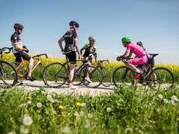
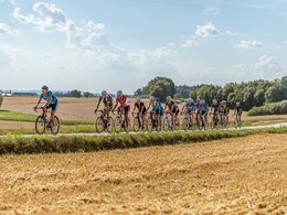
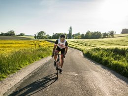
With the racing bike through the Innviertel (hilly tour)
Altheim (Roman museum, private brewery Wurmhöringer, Innviertler Brauturm) - St. Laurenz (church St. Laurenz) - Stern - Gaugsham - Treubach - first smaller climb - Pfendhub (private brewery Pfesch) - Sonnleiten - beautiful view into neighboring Bavaria - St. Florian (pilgrimage church) - Mitterholzleiten - Schalchen - slightly higher climb - Maria Schmolln (pilgrimage church) - Stixeck - again a longer climb - St. Johann am Walde (ski lift) - Klafterreith - a beautiful downhill - Mettmach - Kappeln - Rottersham - Migelsbach - Aspach (Revital, Daringer Art Museum) - Höhnhart (ski jumps) - Herbstheim - Rossbach - St. Veit im Innkreis - Wagham - Altheim
On roads with little traffic and asphalt throughout, you can enjoy the beautiful landscape of the Innviertel. With many sights, cozy inns to stop and other cyclists they experience the history of the Innviertel from the " saddle".
- Suitable for groups
- Suitable for single travelers
- Suitable for friends
- Suitable for couples
- Spring
- Summer
- Autumn
Please get in touch for more information.
4950 Altheim
Phone +43 7723 8555
E-Mail info@innviertel-tourismus.at
Web www.innviertel-tourismus.at
https://www.innviertel-tourismus.at
You can also visit us on
Visit us on Facebook")
")
")
")
")
")
")
")
")
Interactive elevation profile
Create PDF
Tour-Details
Starting place: 4950 Altheim
Destination: 4950 Altheim
duration: 5h 10m
length: 69,8 km
Altitude difference (uphill): 820m
Altitude difference (downhill): 823m
Lowest point: 358m
Highest point: 681m
difficulty: medium
condition: medium
panoramic view: Some Views
Paths covering:
Asphalt
powered by TOURDATA