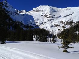
Wurzeralm snowshoe trail
Path number: Schneeschuh-Trail
Starting place: 4582 Spital am Pyhrn
Destination: 4582 Spital am Pyhrn
Wurzeralm 1
4582 Spital am Pyhrn
4582 Spital am Pyhrn

Enjoy the snow-covered winter landscape and the unspoilt nature of the high plateau on the Wurzeralm!
The funicular railway takes you comfortably to the mountain station. From there, follow the signs to Teichlboden. Please only walk along the edge, skiers have priority.
The snowshoe trail (4.6 km) leads along the Wurzeralm high-altitude trail and is signposted.
Before heading home, you can stop for refreshments in the various huts at the mountain station and enjoy the sunshine and the mountain panorama.
The most important tips for snowshoeing off our trail:
- Careful tour planning!
- If you want to set off without a guide, you should choose a tour destination suited to your level of ability, find out about the local wildlife protection and restricted areas and respect them.
- Adapted behaviour - you move in unsecured alpine terrain at your own risk.
- For commercial use (guided snowshoe tours), permission must be obtained from the landowners.
Path number: Schneeschuh-Trail
Starting place: 4582 Spital am Pyhrn
Destination: 4582 Spital am Pyhrn
duration: 1h 19m
length: 4,6 km
Altitude difference (uphill): 101m
Altitude difference (downhill): 86m
Lowest point: 1.358m
Highest point: 1.421m
difficulty: easy
condition: easy
panoramic view: Great panorama
Paths covering:
snow, Other
Starting point: Mountain Station Wurzeralm Funicular - Teichlboden
Destination: Mountain Station Wurzeralm Funicular - Teichlboden
further information:
- Flatly
Accessibility / arrival
Use the free car park on the Wurzeralm.
General price information
An ascent and descent on the Wurzeralm funicular railway is required for this tour.
Prices and opening times of the HIWU mountain railway at www.hiwu.at
- Suitable for groups
- Suitable for schools
- Suitable for teenagers
- Suitable for seniors
- Suitable for single travelers
- Suitable for friends
- Suitable for couples
- Early winter
- Deep winter
Please get in touch for more information.
Wurzeralm 1
4582 Spital am Pyhrn
Phone +43 7564 5275
E-Mail info@hiwu.at
Web www.urlaubsregion-pyhrn-priel.at/
Web skisport.com/de/hiwu
https://www.urlaubsregion-pyhrn-priel.at/
https://skisport.com/de/hiwu
https://skisport.com/de/hiwu


