Wolfgang-Pilgerweg-Fußweg-Etappe 05

  • Multi-day tour

 Interactive elevation profile

Download GPS data
Create PDF

Tour-Details

Starting place: 84137 Vilsbiburg
Destination: 84494 Neumarkt-Sankt Veit

duration: 5h 50m
length: 22,3 km
Altitude difference (uphill): 231m
Altitude difference (downhill): 225m

Lowest point: 442m
Highest point: 515m
difficulty: medium
condition: difficult
panoramic view: Some Views

Paths covering:
Asphalt, Gravel, Hiking trail

powered by TOURDATA

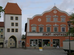
Stage 5 from Vilsbiburg to Neumarkt-St. Veit
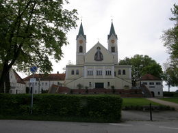
The stage begins with a visit to the Mariahilf pilgrimage site above Vilsbiburg. It then leads from the Vils valley into the Rott valley and is not too strenuous. At the end, you can take your time to visit the St. Veit monastery, which is well worth seeing.
Travelling by public transport
Route planner for independent travellers
  • Suitable for groups
  • Suitable for seniors
  • Suitable for single travelers
  • Suitable for friends
  • Suitable for couples
Most economical season
  • Spring
  • Summer
  • Autumn

Please get in touch for more information.


Wolfgang-Pilgerweg-Fußweg-Etappe 05
Wolfgangsee Tourimus Gesellschaft
Au 140
5360 St. Wolfgang im Salzkammergut

Phone +43 6138 8003
Fax machine +43 6138 8003 - 81
E-Mail info@wolfgangsee.at
Web www.wolfgangsee.at
http://www.wolfgangsee.at

We speak the following languages

German
English

 Interactive elevation profile

Download GPS data
Create PDF

Tour-Details

Starting place: 84137 Vilsbiburg
Destination: 84494 Neumarkt-Sankt Veit

duration: 5h 50m
length: 22,3 km
Altitude difference (uphill): 231m
Altitude difference (downhill): 225m

Lowest point: 442m
Highest point: 515m
difficulty: medium
condition: difficult
panoramic view: Some Views

Paths covering:
Asphalt, Gravel, Hiking trail

powered by TOURDATA