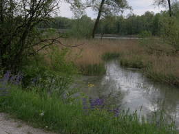
The Wolfgang-pilgrimage-hikingtrail-stage 06

  • Multi-day tour

 Interactive elevation profile

Download GPS data
Create PDF

Tour-Details

Starting place: 84494 Neumarkt-Sankt Veit
Destination: 84503 Altötting

duration: 7h 38m
length: 29,7 km
Altitude difference (uphill): 243m
Altitude difference (downhill): 279m

Lowest point: 369m
Highest point: 499m
difficulty: medium
condition: difficult
panoramic view: Some Views

Paths covering:
Asphalt, Gravel, Hiking trail

powered by TOURDATA

Travelling by public transport
Route planner for independent travellers
  • Suitable for groups
  • Suitable for seniors
  • Suitable for single travelers
  • Suitable for friends
  • Suitable for couples
Most economical season
  • Spring
  • Summer
  • Autumn

Please get in touch for more information.


The Wolfgang-pilgrimage-hikingtrail-stage 06
Wolfgangsee Tourimus Gesellschaft
Au 140
5360 St. Wolfgang im Salzkammergut

Phone +43 6138 8003
Fax machine +43 6138 8003 - 81
E-Mailinfo@wolfgangsee.at
Webwww.wolfgangsee.at
http://www.wolfgangsee.at

We speak the following languages

German
English

 Interactive elevation profile

Download GPS data
Create PDF

Tour-Details

Starting place: 84494 Neumarkt-Sankt Veit
Destination: 84503 Altötting

duration: 7h 38m
length: 29,7 km
Altitude difference (uphill): 243m
Altitude difference (downhill): 279m

Lowest point: 369m
Highest point: 499m
difficulty: medium
condition: difficult
panoramic view: Some Views

Paths covering:
Asphalt, Gravel, Hiking trail

powered by TOURDATA