Lynx Trail Stage 03

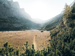
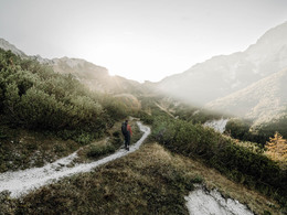
Back to civilisation: over the Haller Mauern to Admont with the famous Admont Abbey.
From the Laussabaueralm, follow the "Klosterweg" signs, cross the Karbach stream to the east, enter the forest and climb over a game fence. Then keep left and follow the forest road downstream. Keep right at the next junction and follow the forest road to the Simandlalm, where you continue on the forest road to the left. Cross the Laussabach stream over a bridge and reach the Hengstpass road. Follow this road downstream on the right for just under a kilometre and turn right into the Pölztal valley (trail no. 633) before reaching Gasthof Sagwirt (Oberzwiesel car park, 691m, Oberlaussa). Follow the slightly ascending forest road and the Pölzalmbach stream uphill. You will pass some hunting and mountain hut buildings.
At the Admonter Haus, you take the path downhill to Hall (2.5 hours). The trail leads through alpine pastures into a very natural forest. Passing the Johannesbründl, you will quickly reach Hall and Admont.
In Admont, however, you should not think about putting your feet up just yet, as a visit to the famous Admont Abbey with its small national park exhibition "Passion of the Explorer" is highly recommended.
Equipment
Sturdy hiking boots or good trekking shoes, as well as a hiking rucksack with the appropriate contents (water bottle, blister plasters, hiking map, snack, etc.). You should also be well prepared for a change in the weather. Don't forget your sleeping bag for overnight stays in the huts!
Further information and links
Booking centre & general info hotline Trail Angels GmbH
Obervellach 15, 9821 Obervellach
Tel.+43 47 82 93 093
web: bookyourtrail.com
Email: info@bookyourtrail.com
Infostelle Oberösterreich:
Tourismusverband Pyhrn Priel
Bahnhofstraße 2, 4580 Windischgarsten
Tel.: +43 7562 5266
Email: info@pyhrn-priel.net
Infostelle Steiermark:
Tourismusverband Alpenregion Nationalpark Gesäuse
Hauptstraße 35, 8911 Admont, Austria
Tel. +43 (0) 3613 21160 10
Email: info@gesaeuse.at
Infostelle Niederösterreich: Mostviertel Tourismus GmbH
Töpperschloss Neubruck
Neubruck 2/10, 3283 Scheibbs
Tel.+43 (0)7482/204 44
Email: info@mostviertel.at
Paths covering:
further information:
- Multi-day tour
- Possible accommodation
- Board possible
Details - hiking
- themed path
Coming from stage 02...
or
From 1 May to 26 October on-call bus service from Windischgarsten train station to Henstpaß-Passhöhe and back (line 435)
Tel. + 43 664 90 7 60 20, book at least 30 minutes before bus departure from the first bus stop. Company Rebhandl, Roßleithen
Timetable query: http://fahrplan.oebb.at/
Footpath approx. 1 hour to the Laussabaueralm !!! From the Hengstpaß-Passhöhe you walk along a goods road for approx. 15 minutes towards Egglalm. Shortly before the Alm, turn left onto the cart track and hike approx. 40 minutes towards the Red Cross Chapel and along the Red Cross stream to the Laussabaueralm.
Here you will find various offers on the Luchstrail
Booking centre & general info hotline Trail Angels GmbH
Obervellach 15, 9821 Obervellach
Tel.+43 47 82 93 093
web: bookyourtrail.com
Email: info@bookyourtrail.com
- Suitable for single travelers
- Suitable for friends
- Suitable for couples
- Spring
- Summer
- Autumn
Please get in touch for more information.
4581 Rosenau am Hengstpaß
Phone +43 7562 5266
E-Mail info@pyhrn-priel.net
Web luchstrail.at/
Web www.bookyourtrail.com/trail/luchs-t…
https://www.bookyourtrail.com/trail/luchs-trail/angebote


