Hochsteinalm in Traunkirchen
Starting place: 4801 Traunkirchen
Destination: 4801 Traunkirchen
Hochsteinalm 1
4801 Traunkirchen
4801 Traunkirchen

From Traunkirchen (urban district "Winkl") from the parking place (marked with the No.1) at the end of a the route Mühlbachberg.
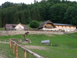
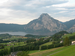
The Hochsteinalm is on a hill in a valley. The large garden with stunning views of the mountains "Höllengebirge" and the Brunnkogel invites you to stop. Specialties from the highlands and a hearty beef and lamb roast and homemade Pofesen are on our menu.
For younger guests there is a playground in sight of the garden and lots of pets.
Starting place: 4801 Traunkirchen
Destination: 4801 Traunkirchen
duration: 0h 49m
length: 2,9 km
Altitude difference (uphill): 271m
Altitude difference (downhill): 17m
Lowest point: 668m
Highest point: 940m
difficulty: easy
condition: easy
panoramic view: Great panorama
Paths covering:
Hiking trail
Starting point: Mühlbachberg - parking place Röd
Destination: Hochsteinalm
further information:
- culinary interesting
- Possible accommodation
- Board possible
daily open
Monday: closed
Holiday: November
Accessibility / arrival
bus travel
Buses over 3.4 meters height:
B145 Gmunden - Altmünster - Neukirchen 500 meters from the sports field - turn left towards Traunkirchen - Station - Gasthof Annerlhof 20 meters to the right - mountain road 4km - first parking place (field) on the left - no reverse option above - Allow about 10 minutes longer.
Buses and cars below 3.4 meters height:
B145 - Gmunden - Altmünster - Winkl - after fire department 50m right - signposted.
- Parking space: 40
Payment methods
Cash payment
- All weather
- Suitable for groups
- Suitable for schools
- Suitable for kids (0 - 14 Year)
- Suitable for kids (all ages)
- Suitable for pushchairs
- Pets allowed
- Suitable for single travelers
- Suitable for families
- Suitable for friends
- Suitable for children
- Spring
- Summer
- Autumn
- Early winter
- Deep winter
Please get in touch for more information.
Hochsteinalm 1
4801 Traunkirchen
Phone +43 664 9875221
E-Mail info@hochsteinalm.at
Web www.hochsteinalm.at
http://www.hochsteinalm.at


