Ramsebenrunde - "The Sporty"
Starting place: 4574 Vorderstoder
Destination: 4574 Vorderstoder
Uphill and downhill, it is a sporty hike through the meadows and forests of Vorderstoder, over streams and mountain slopes.
If you like variety, you will love this hike full of views.
At the Bucheben crossroads, continue straight on, then keep right through the forest.
Continue on the road to the right and, after the bridge, take the right-hand "Weierriegel" goods road again. Watch out for the fork that soon goes steeply away to the left across a meadow slope.
Soon you reach a gravel road and turn left until you reach the Hubertus Chapel. From the chapel, the trail continues on the road past a refreshing spring.
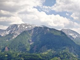
After about 15 minutes, you reach a fork at the small Wurzer farm and turn right. The trail now descends over meadow slopes with a great view of the Warscheneck back to the village.
Starting place: 4574 Vorderstoder
Destination: 4574 Vorderstoder
duration: 2h 30m
length: 5,9 km
Altitude difference (uphill): 325m
Altitude difference (downhill): 323m
Lowest point: 683m
Highest point: 1.002m
difficulty: easy
condition: easy
panoramic view: Great panorama
Paths covering:
Asphalt, Gravel, Hiking trail, Other
Starting point: Municipal office Vorderstoder
Destination: Municipal office Vorderstoder
further information:
- Flatly
- Possible accommodation
Accessibility / arrival
Start and finish is located directly in the local center of Vorderstoder at the municipal office.
- Suitable for groups
- Suitable for schools
- Pets allowed
- Suitable for teenagers
- Suitable for seniors
- Suitable for single travelers
- Suitable for families
- Suitable for friends
- Suitable for couples
- Spring
- Summer
- Autumn
Please get in touch for more information.
Nr. 66
4574 Vorderstoder
Phone +43 7564 8255
Fax machine +43 7564 8255 - 20
E-Mail vorderstoder@pyhrn-priel.net
Web www.urlaubsregion-pyhrn-priel.at
https://www.urlaubsregion-pyhrn-priel.at


