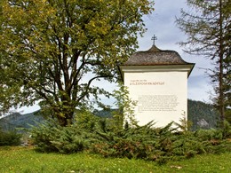
Saukogelrunde - "The Peasant"
Starting place: 4574 Vorderstoder
Destination: 4574 Vorderstoder
We begin our hike in the direction of Steinergut, where we turn left into the goods road Ramseben. After a short path we turn right into the Herzogsiedlung and follow the signs "Saukogelrunde" until we reach a forest.
The Saukogelrunde continues through the farm Saukogel and down on an asphalt road to the Filzmoosergut and past the Filzmooserkapelle. The last piece through the fen with its special flora is again a very special experience. After the forest stadium we soon reach the village Vorderstoder.
Starting place: 4574 Vorderstoder
Destination: 4574 Vorderstoder
duration: 1h 30m
length: 4,8 km
Altitude difference (uphill): 194m
Altitude difference (downhill): 184m
Lowest point: 782m
Highest point: 939m
difficulty: easy
condition: easy
panoramic view: Great panorama
Paths covering:
Asphalt, Hiking trail, Other
Starting point: Municipal office Vorderstoder
Destination: Municipal office Vorderstoder
further information:
- Flatly
Accessibility / arrival
Start and finish is located directly in the local center of Vorderstoder at the municipal office.
- Suitable for groups
- Suitable for schools
- Suitable for teenagers
- Suitable for seniors
- Suitable for single travelers
- Suitable for families
- Suitable for friends
- Suitable for couples
- Suitable for children
- Spring
- Summer
- Autumn
Please get in touch for more information.
Nr. 66
4574 Vorderstoder
Phone +43 7564 8255
Fax machine +43 7564 8255 - 20
E-Mail vorderstoder@pyhrn-priel.net
Web www.urlaubsregion-pyhrn-priel.at
https://www.urlaubsregion-pyhrn-priel.at
powered by TOURDATA


