Waldluftbadeweg Thurytal
Path number: Route mit grünen Legenden
Starting place: 4240 Freistadt
Destination: 4240 Freistadt
Waaggasse 6
4240 Freistadt
4240 Freistadt

The forests of Freistadt
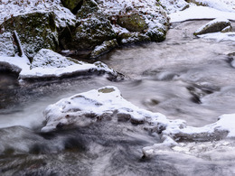
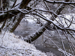
The forests of Freistadt can be found along the Feldaist in the Thurytal and on the steep slopes of the surrounding hills, such as the Bockau in the west and the Zelletau in the east. You can still sense the energy of the primeval landscape - water that once flowed from these slopes through what was once moorland and flowed into the Feldaist. The special character of this horseshoe-shaped landscape suggests that this is a scenic centre of the Mühlviertel. The basic quality is emotional, sensual and fertile. This is exactly where a successful trading town could thrive.
The valley was an ancient healing valley and must have been very important for the people of the region. In order to "wean" them off the old practices, several legends of the devil had to be used. It literally became a "war" between the old (giants) and new (devils) religions ...
After the mouths of the Grünbach and Prembach rivers into the Aist - two places of great impact - the route finally crosses the Aist to the Neumühle mill. The way back to Freistadt leads back to the town via Hammerleiten.
Side trip: From the Neumühle mill up through forest paths to the village of Vierzehn and on to the Dreißgerberg, the landscape centre of Freistadt. Via the Bockau on the meditation trail back to the town.
Thurytal forest air bathing trail - waypoints
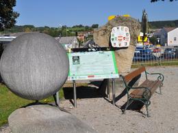
- Hiking stone
- Hafnerzeile, ditch
- First Thuryhammer
- Second Thuryhammer
- Stream meadow
- Barrage
- Third Thuryhammer
- Resting and bathing place
- Devil's rock
- Mouth of Grünbach
- Prembach estuary
- New mill
- Hammerleiten
For guided tours, please contact our qualified forest air bathing masters - you can find more information here.
Path number: Route mit grünen Legenden
Starting place: 4240 Freistadt
Destination: 4240 Freistadt
duration: 2h 45m
length: 9,3 km
Altitude difference (uphill): 229m
Altitude difference (downhill): 231m
Lowest point: 553m
Highest point: 653m
difficulty: easy
condition: easy
panoramic view: Individual Views
Paths covering:
Hiking trail, Other
Starting point: Wanderstein Freistadt
Destination: Hammerleiten Freistadt
further information:
- Flatly
Details - hiking
- themed path
Accessibility / arrival
Free parking at the car park (old tennis court) next to the Frauenteich pond
Parking- Parking space: 100
- All weather
- Suitable for groups
- Suitable for schools
- Suitable for teenagers
- Suitable for seniors
- Suitable for single travelers
- Suitable for families
- Suitable for friends
- Suitable for couples
- Suitable for children
- Spring
- Summer
- Autumn
- Early winter
Please get in touch for more information.
Waaggasse 6
4240 Freistadt
Phone +43 5 07263 - 301
E-Mail badzell@muehlviertel.at
Web www.muehlviertel.at
Web www.muehlviertel-urlaub.at/wandern
https://www.muehlviertel.at
http://www.muehlviertel-urlaub.at/wandern
http://www.muehlviertel-urlaub.at/wandern


