Waldluftbadeweg Ost Reichenstein - Pregarten
Path number: Route mit blauen Legenden
Starting place: 4230 Pregarten
Destination: 4230 Pregarten
Stadtplatz 12
4240 Freistadt
4240 Freistadt

information: Wanderweg ist Digital aufbereitet
Forest air bathing in Pregarten
Pregarten lies in the Central Mühlviertel highlands and forms the land between the Feldaist and Waldaist rivers. The centre of the Pregarten landscape organism is the hill south of Pregartsdorf near the Hubertus Chapel.
Pregarten is part of the larger landscape organism "Untere Feldaist" (Hagenberg, Pregarten, Wartberg, Unterweitersdorf). The neighbouring Aist-Naarn-Kuppenland lies to the east and is bordered by the Waldaist. The southern Feldaist valley between the municipalities of Pregarten and Wartberg ob der Aist is the first landscape conservation area in Upper Austria, covering 45 hectares, and the Waldaist valley has been designated a European nature reserve.
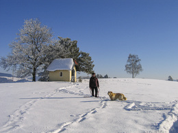
The path leads from the town square northwards along the Kirchensteig to Pregartsdorf. An alternative path leads down to the Feldaist, past the Kumpfmühle and then eastwards towards Pregartsdorf. A little to the south is a hill with the Hubertus Chapel. This place combines all the elemental energies of the landscape and supplies the land with vital energy.
We follow the church path and descend via the Gmeinerhof and the neighbouring Vogeltenn into the Waldaist valley to Reichenstein Castle.
Reichenstein Castle lies at the intersection of the three municipalities of Pregarten, Gutau and Tragwein at a strong double bend in the Waldaist. There were former places of worship at the castle chapel and on the Calvary. This was also the site of the first wooden castle, of which nothing remains today. Reichenstein Castle impresses with its frescoed Knights' Hall and the castle chapel, which was renovated a few years ago. The Upper Austrian Castle Museum also has a Natura 2000 exhibition on the topics of forests and river pearl mussels.
From the castle, we follow the Parsteinerbach stream and climb back up to the highlands via the Parsteinertal valley. In Pregartsdorf, the trail crosses the Burbach valley and returns to Pregarten.
The Halmenberg and Greisingberg are recommended as detours for short excursions.
Waldluftbadeweg Reichenstein - waypoints
1. hiking stone town square
2. church path
3rd Pregartsdorfer Berg
4th Kirchensteig, chapel
5. Vogeltenn Gmeinerhof
6th Reichensteinbach/Waldaist
7th Reichenstein
8th Calvary
9th Parsteiner-/Gaisruckbach
10. Parsteinertal
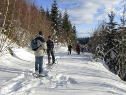
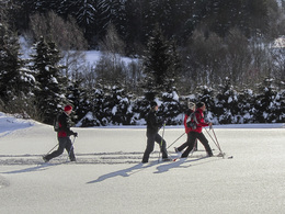
This hiking trail is possible as a snowshoe trail.
For guided tours, please contact our qualified forest air bathing masters - you can find more information here.
Path number: Route mit blauen Legenden
Starting place: 4230 Pregarten
Destination: 4230 Pregarten
duration: 3h 34m
length: 12,2 km
Altitude difference (uphill): 301m
Altitude difference (downhill): 297m
Lowest point: 360m
Highest point: 516m
difficulty: easy
condition: easy
panoramic view: Individual Views
Paths covering:
Hiking trail, Other
Starting point: Hiking stone Bruckmühle
Destination: Hiking stone Bruckmühle
further information:
- Flatly
Details - hiking
- themed path
- All weather
- Suitable for groups
- Suitable for schools
- Suitable for teenagers
- Suitable for seniors
- Suitable for single travelers
- Suitable for friends
- Suitable for couples
- Spring
- Summer
- Autumn
- Early winter
Please get in touch for more information.
Stadtplatz 12
4240 Freistadt
Phone +43 7236 2255 - 1
E-Mail freistadt@muehlviertel.at
Web www.waldluftbaden.at
http://www.waldluftbaden.at


