Gebetsberger-Loipe
Starting place: 4372 St. Georgen am Walde
Destination: 4372 St. Georgen am Walde
Markt 9
4372 St. Georgen am Walde
4372 St. Georgen am Walde

Not in operation
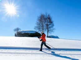
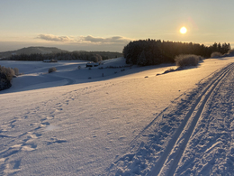
14.2 km of double-tracked trails and 3.2 km of skating trails lead cross-country skiers into a magical snow-covered landscape!
Access to the Gebetsberger trail (classic) 6.4 km: Entrance car park Jausenstation Gebetsberger (Linden 53) and entrance car park Schaureithner (2.5 km after the end of Linden - direction Arbesbach - then turn right into the Haruckstein goods road) Starting place: 4372 St. Georgen am Walde
Destination: 4372 St. Georgen am Walde
duration: 2h 0m
length: 6,4 km
Altitude difference (uphill): 65m
Altitude difference (downhill): 62m
Lowest point: 848m
Highest point: 909m
difficulty: easy
condition: easy
panoramic view: Some Views
Paths covering:
snow
Starting point: Access to the Gebetsberger trail (classic) 6.4 km: Entrance parking lot Jausenstation Gebetsberger (Linden 53) and entrance parking lot Schaureithner (2.5 km after the end of Linden - direction Arbesbach - then turn right into the Güterweg Haruckstein)
Details - Trail
- Nordic skiing facilities: Marked Nordic skiing run
- Type of Nordic skiing run: Classic style
42, Linden, Bezirk Perg, Oberösterreich, 4372, Austria
Accessibility / arrival
by car:
from Vienna: A1 to Amstetten exit - B 119 via Grein to St. Georgen am Walde
from Salzburg: A1 to exit Enns - B 3 to Perg - Münzbach - Pabneukirchen - St. Georgen am Walde
by train:
Linz main station - train to Perg - Postbus to St. Georgen am Walde
by plane:
Linz/Hörsching airport - car or train to Perg - St. Georgen am Walde.
by boat:
on the Danube to Grein landing stage - Postbus to St. Georgen am Walde
Payment methods
Cash payment
Most economical season
- Deep winter
Please get in touch for more information.
Markt 9
4372 St. Georgen am Walde
Phone +43 7954 3030 - 20
Fax machine +43 7954 3030 - 30
E-Mail tourismus@st.georgen.at
Web www.langlaufen.st.georgen.at
Web www.aktivwelt.eu
https://www.langlaufen.st.georgen.at
http://www.aktivwelt.eu
http://www.aktivwelt.eu


