Kleine Gutauer Runde
4293 Gutau

Route
Gutau - St. Oswalderstraße - Wimmer Höhe - Walchslehner - Fraulehner - Gusner - St.Oswalderstraße - Gutau
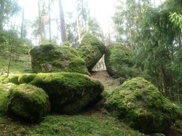
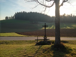
The Kleine Gutauer Runde gives a nice impression of the hilly nature of the Mühlviertel. This leads via St. Oswalderstraße and the Pfarrerwald forest on the left after the waste collection centre to the Wimmer Höhe and the Walchslehnerhof. Turn right onto tarmac and then left at the iron cross onto a meadow path to reach the Maria Bründl district road and then the Kagerer access road. Turn right past the Kagerer farm over gravel and meadows towards the Lehen goods road. 100 metres after the Schöferberg junction, a forest path opens up on the right, which finally leads into the Maria Bründl district road. Turning left, it is just 800 metres to the market square with its inns and cafés.
Paths covering:
further information:
- Flatly
- Spring
- Summer
- Autumn
Please get in touch for more information.
St. Oswalderstraße 2
4293 Gutau
Phone +43 7946 6255
E-Mail gemeinde@gutau.ooe.gv.at
Web www.gutau.at/tourismus-freizeit.htm…


