Schwarze Mandl Runde
4293 Gutau

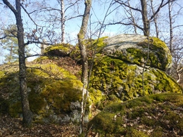
The name of the trail is based on an old legend that tells of the mysterious black Mandl on the high stone. From the car park at the chapel in Führling, the trail leads towards the village of Nußbaum. After 70 metres, the trail continues half-left on a gravel path to "Hinterleithen", where hikers enter an airy section of forest. On the right, the granite towers up to the legendary "high stone". A wayside shrine reminds us that special forces are at work here.
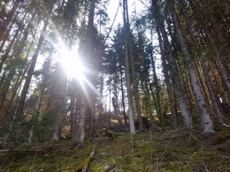
On gravel, lined with very old giant trees, the path slopes slightly downhill to the Hinterleitner house in Stampfendorf 3. After a short stretch of meadow, the idyllic forest path descends steeply. The view encompasses the romantic Stampfenbach valley all the way up to St. Leonhard. At the junction with a forest road, keep left and follow the slightly ascending forest path until you reach the Schnabling goods road after around one kilometre. The route now leads back to Fürling on asphalt for around 400 metres, where the friendly innkeepers at Gasthaus Rampetsreiter (Wirt auf der Fürling) invite you to stop for refreshments.
The Black Mandl
A beer driver was travelling late at night with his team of oxen. He passed the Hoher Stein when a black man suddenly stood in his way. (It was the place where a cross stands today). The oxen shied away from the sinister figure and plunged down the slope along with the wagon and beer barrels. Frightened, the carter hurried back to the
back to the inn and called for help. By the light of the oil lamp, they found the half-dead oxen with their horns twisted out. The sturdy cart was shattered. There was no trace of the black Mandl.
Fürlinger treasure hunters
This story tells of a legendary treasure that is said to be buried near the Hoher Stein. In order to unearth it, you were not allowed to speak or look up while digging. Some lads from the village tried their luck as treasure diggers. They had already
uncovered the iron chest. As they were about to lift the chest, one of them was blinded by the light of a fire. He looked up and saw that St Leonhard was on fire.
Suddenly the chest sank. The treasure was later dug for several more times, but no one ever got to see it.
Fürlingen legends-WH V.3 -2012
Paths covering:
further information:
- Flatly
- Spring
- Summer
- Autumn
Please get in touch for more information.
St. Oswalderstraße 2
4293 Gutau
Phone +43 7946 6255
E-Mail gemeinde@gutau.ooe.gv.at
Web www.gutau.at/tourismus-freizeit.htm…


