

Mattighofner Verbindungsweg


Interactive elevation profile
Create PDF
Tour-Details
Starting place: 5230 Mattighofen
Destination: 5230 Mattighofen
duration: 0h 7m
length: 2,4 km
Altitude difference (uphill): 12m
Altitude difference (downhill): 8m
Lowest point: 441m
Highest point: 458m
difficulty: medium
condition: easy
panoramic view: No view
powered by TOURDATA
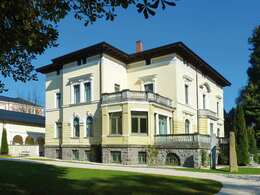
This path serves as a link between the cycle paths that run to the right and left of Mattighofen and leads directly through the town centre of Mattighofen.
Most economical season
- Spring
- Summer
- Autumn
Please get in touch for more information.
Stadtplatz 2
5230 Mattighofen
Phone +43 7722 626440
E-Mail info@entdeckerviertel.at
Web www.entdeckerviertel.at/
https://www.entdeckerviertel.at/
Interactive elevation profile
Create PDF
Tour-Details
Starting place: 5230 Mattighofen
Destination: 5230 Mattighofen
duration: 0h 7m
length: 2,4 km
Altitude difference (uphill): 12m
Altitude difference (downhill): 8m
Lowest point: 441m
Highest point: 458m
difficulty: medium
condition: easy
panoramic view: No view
powered by TOURDATA