La 2 Spazierweg
Path number: La 2
Starting place: 4291 Lasberg
Destination: 4291 Lasberg
Markt 26
4240 Lasberg
4240 Lasberg

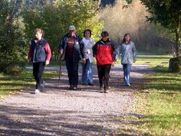
This leisurely loop in the direction of St. Oswald is about one third on asphalt and two thirds on forest paths and country lanes around the market and offers a clear view of the village and its leisure facilities: the leisure pond, the outdoor pool, the beach volleyball and streetball court, the skate park and the children's playground at the Lasbergerstüberl.
Tip:
Popular running route
Path number: La 2
Starting place: 4291 Lasberg
Destination: 4291 Lasberg
duration: 1h 10m
length: 4,3 km
Altitude difference (uphill): 69m
Altitude difference (downhill): 69m
Lowest point: 562m
Highest point: 635m
difficulty: easy
condition: easy
panoramic view: No view
Paths covering:
Asphalt, Hiking trail
Starting point: at the market square to the north towards Hagelgasse
Destination: Marketplace
further information:
- Flatly
Most economical season
- Spring
- Summer
- Autumn
Please get in touch for more information.
Markt 26
4240 Lasberg
Phone +43 7947 7255 - 13
E-Mail tourismuskern@lasberg.at
Web www.lasberg.at
Web www.muehlviertel-urlaub.at/wandern
https://www.lasberg.at
https://www.muehlviertel-urlaub.at/wandern
https://www.muehlviertel-urlaub.at/wandern


