

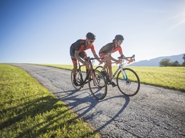
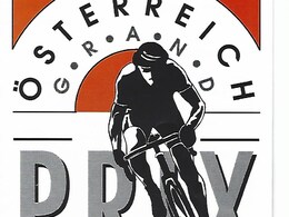
Rennrad-Tour “ÖSTERREICH GRAND PRIX“


- Flatly
Interactive elevation profile
Create PDF
Tour-Details
Starting place: 4950 Altheim
Destination: 4950 Altheim
duration: 6h 33m
length: 87,3 km
Altitude difference (uphill): 1.107m
Altitude difference (downhill): 1.109m
Lowest point: 357m
Highest point: 621m
difficulty: difficult
condition: difficult
panoramic view: Great panorama
Paths covering:
Asphalt
powered by TOURDATA
On the trail of the racing bike classic "AUSTRIA GRAND PRIX
From the town square Altheim over the Ache, past the Gothic church St. Laurenz to Stern, Gaugsam and Treubach. At the sports field Treubach to Obertreubach, Breitenberg, Teiseneck, Haslau and Maria Schmolln.
Here we start a big and small round of the Austria Grand Prix. From Maria Schmolln to Warleiten, Dobl, Obereck, St. Johann and Höhnhart (ski jumping center). In the center uphill Leitrachstetten, Bucheck, Haslau and again up the Schmollner Berg. From here we go into the "small round" of the Grand Prix, traffic circle, Sollach, Thannstrass, Haslau and once again up the Schmollner Berg.
On the way back to the starting point Altheim via Warleiten, Höhnhart, Aspach, at the school center Aspach to Mitterberg, Wildenau, towards Mettmach, in Duttenberg to Katzenberg, Aichet, Edt, Kasting and following the Roman bike path to the starting point town square Altheim.
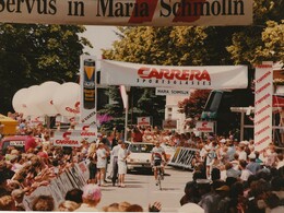
The road bike tour on the edge of the Kobernaußerwald in the style of the "Austria Grand Prix", one of the most difficult bicycle races in Austria, in the years 1987 to 1992. With 202 km in length and 3,300 total meters of altitude, the Grand Prix was considered Austria's most difficult bicycle race.
The route profile resembles that of a "Tour de France - Pyrenees stage". The Kirchensteig in St. Johann, the Hochstraße in Höhnhart and the Schmollner Berg are considered special criteria. In order to let the spectators and media participate even more in the race after 6 rounds á 27,4 km in the finish, this event was finished at that time with 5 small rounds á 7,5 km.
From the town square Altheim over the Ache, past the Gothic church St. Laurenz to Stern, Gaugsam and Treubach. At the sports field Treubach to Obertreubach, Breitenberg, Teiseneck, Haslau and Maria Schmolln.
Here we start a big and small round of the Austria Grand Prix. From Maria Schmolln to Warleiten, Dobl, Obereck, St. Johann and Höhnhart (ski jumping center). In the center uphill Leitrachstetten, Bucheck, Haslau and again up the Schmollner Berg. From here we go into the "small round" of the Grand Prix, traffic circle, Sollach, Thannstrass, Haslau and once again up the Schmollner Berg.
On the way back to the starting point Altheim via Warleiten, Höhnhart, Aspach, at the school center Aspach to Mitterberg, Wildenau, towards Mettmach, in Duttenberg to Katzenberg, Aichet, Edt, Kasting and following the Roman bike path to the starting point town square Altheim.
The road bike tour on the edge of the Kobernaußerwald in the style of the "Austria Grand Prix", one of the most difficult bicycle races in Austria, in the years 1987 to 1992. With 202 km in length and 3,300 total meters of altitude, the Grand Prix was considered Austria's most difficult bicycle race.
The route profile resembles that of a "Tour de France - Pyrenees stage". The Kirchensteig in St. Johann, the Hochstraße in Höhnhart and the Schmollner Berg are considered special criteria. In order to let the spectators and media participate even more in the race after 6 rounds á 27,4 km in the finish, this event was finished at that time with 5 small rounds á 7,5 km.
- Suitable for groups
- Suitable for single travelers
- Suitable for friends
- Suitable for couples
- Spring
- Summer
- Autumn
Please get in touch for more information.
4950 Altheim
Phone +43 7723 8555
E-Mail info@innviertel-tourismus.at
Web www.innviertel-tourismus.at/aktivit…
https://www.innviertel-tourismus.at/aktivitaeten/radfahren/radtouren.html
Interactive elevation profile
Create PDF
Tour-Details
Starting place: 4950 Altheim
Destination: 4950 Altheim
duration: 6h 33m
length: 87,3 km
Altitude difference (uphill): 1.107m
Altitude difference (downhill): 1.109m
Lowest point: 357m
Highest point: 621m
difficulty: difficult
condition: difficult
panoramic view: Great panorama
Paths covering:
Asphalt
powered by TOURDATA