

natur.BANK.wege | Reichraming | Ortszentrum | 446201


- Suitable for families
- Suitable for pushchairs
Interactive elevation profile
Create PDF
Tour-Details
Starting place: 4462 Reichraming
Destination: 4462 Reichraming
duration: 0h 4m
length: 0,3 km
Altitude difference (uphill): 10m
Altitude difference (downhill): 5m
Lowest point: 347m
Highest point: 357m
difficulty: easy
condition: very easy
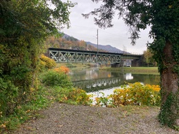
panoramic view: Great panorama
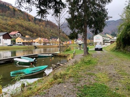
Paths covering:
Asphalt, Gravel
powered by TOURDATA
Short description:
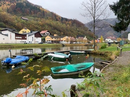
A place to relax
A place to relax
Quality of experience: ****
Recommended season:
- January
- February
- March
- April
- May
- June
- July
- August
- September
- October
- November
- December
Properties:
- Round trip
- Scenic
- Refreshment stops available
- Family friendly
- Suitable for strollers
- Disability access
Tip:
Bakery-Cafe Hohlrieder
Additional information:
Adventure Arena Schallau
Starting point: Local centre Reichraming
Destination: Local centre Reichraming
further information:
- Board possible
Accessibility / arrival
Parking
Local centre Reichraming
Getting there
Arrival by train:
The Ennstalbahn runs between Linz and Weißenbach-St. Gallen.
Arrival by car:
From Salzburg/Linz: A1 motorway exit Enns-Steyr > B115 into the Ennstal
From Vienna: A1 motorway exit Haag > B42 > B122 > B115 into the Ennstal
From Passau: A8 Passau > Wels > A1 to motorway exit Enns-Steyr > B115 into the Ennstal
From Graz: A9 Pyhrn motorway > motorway exit Klaus > Grünburg > into the Ennstal
Parking
Local centre Reichraming
- Suitable for pushchairs
- Spring
- Summer
- Autumn
- Early winter
- Deep winter
Completely suitable for wheelchairs. The object complies with the legally stipulated ÖNORM.
Stadtplatz 27
4400 Steyr
Phone +43 7252 53229 - 0
E-Mail info@steyr-nationalpark.at
Web www.steyr-nationalpark.at/
https://www.steyr-nationalpark.at/
Interactive elevation profile
Create PDF
Tour-Details
Starting place: 4462 Reichraming
Destination: 4462 Reichraming
duration: 0h 4m
length: 0,3 km
Altitude difference (uphill): 10m
Altitude difference (downhill): 5m
Lowest point: 347m
Highest point: 357m
difficulty: easy
condition: very easy
panoramic view: Great panorama
Paths covering:
Asphalt, Gravel
powered by TOURDATA