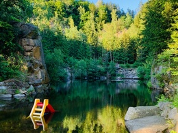
Gloxwald round
Starting place: 4391 Waldhausen im Strudengau
Destination: 4391 Waldhausen im Strudengau
Markt 14
4391 Waldhausen im Strudengau
4391 Waldhausen im Strudengau

Short description:
Wonderful circular hike to the Gloxwald district with many noteworthy highlights (Predigtstuhl with Felsenreiter) and impressive viewpoints
Wonderful circular hike to the Gloxwald district with many noteworthy highlights (Predigtstuhl with Felsenreiter) and impressive viewpoints
Quality of experience: ******
Recommended season:
- January
- February
- March
- April
- May
- June
- July
- August
- September
- October
- November
- December
Properties:
Description:- Loop
- Scenic
- Refreshment stops available
- Cultural/historical value
- Geological highlights
- Summit route
Start at the marketplace, initially heading southeast on the Nitterl farm road to Neulinghoh. From there, the path climbs through the forest to Toberspitz (short detour to the viewpoint), then past the sacrificial bowls to Gloxwald and further to Predigtstuhl I and II (wonderful viewpoints into the Danube valley of the Strudengau with natural climbing garden and Donausteig summit sculpture). Down to the country road (toll) and through the Höllgraben, left at Dobmühle towards Dörfler on the Sattlgai farm road continuing to Alpenblick (viewpoint) and back to the starting point via Herndlhof and Bertaruhe.Tip:
- Donausteig summit: Felsenreiter on the Donausteig
Take your time to admire the sculpture. The background includes mystical legends of the region about the Danube nymph, the Felsenreiter, and many more. You can also read about them at www.donauregion.at (Danube legends) Exploration trips with a delightful stop! This route passes directly by the following culinary partner:
Gasthof Schauer
Hiking backpack (including rain cover), sturdy footwear
Bring your own food. Refreshment options are only available at the start/finish point.
Starting place: 4391 Waldhausen im Strudengau
Destination: 4391 Waldhausen im Strudengau
duration: 5h 30m
length: 19,1 km
Altitude difference (uphill): 525m
Altitude difference (downhill): 525m
Lowest point: 392m
Highest point: 731m
difficulty: medium
condition: difficult
panoramic view: Dreamtour
Paths covering:
Asphalt, Other
Starting point: Info point at the marketplace
Destination: Info point at the marketplace
further information:
- Flatly
- Board possible

Rastplatz Berta Ruhe

Rastplatz Predigtstuhl
Accessibility / arrival
Parking
200 m near Unimarkt
Public Transit
How to get to the Upper Austria Danube region?
The fastest way to the destination – by train, bus, car, ship, or airplane.
Starting point directly at the bus stop Waldhausen in Strudengau market
Parking
200 m near Unimarkt
Most economical season
- Spring
- Summer
- Autumn
- Early winter
- Deep winter
Please get in touch for more information.
Markt 14
4391 Waldhausen im Strudengau
Phone +43 7260 4505
E-Mail gemeinde@waldhausen.ooe.gv.at
Web www.tourismus-waldhausen.com
https://www.tourismus-waldhausen.com


