

NAHTUR Herb and Bee Trail
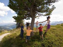

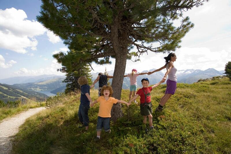

- Suitable for families
- Flatly
Interactive elevation profile
Create PDF
Tour-Details
Starting place: 4463 Großraming
Destination: 4463 Großraming
duration: 0h 39m
length: 2,6 km
Altitude difference (uphill): 25m
Altitude difference (downhill): 25m
Lowest point: 485m
Highest point: 510m
difficulty: easy
condition: easy
panoramic view: Some Views
Paths covering:
Asphalt, Gravel
powered by TOURDATA
Short description:
Freely according to the motto: herbs heal - herbs taste - herbs make beautiful - the herb and bee nature trail "Nahturspur" stretches along the old forest railway line in Brunnbach. Research-based learning opportunities make it possible to experience the regional plant world and the symbiosis of bee and plant. The focus is on free experience in and with nature.
Freely according to the motto: herbs heal - herbs taste - herbs make beautiful - the herb and bee nature trail "Nahturspur" stretches along the old forest railway line in Brunnbach. Research-based learning opportunities make it possible to experience the regional plant world and the symbiosis of bee and plant. The focus is on free experience in and with nature.
Technique: *
Quality of experience: ****
Recommended season:
- January
- February
- March
- April
- May
- June
- July
- August
- September
- October
- November
- December
Properties:
- Loop
- Refreshment stops available
- Family friendly
- Botanical highlights
About 100 years ago, due to a major bark beetle disaster in the Brunnbach valley, the so-called forest railway line was built, which served to transport 1 million solid cubic meters of wood. Until the beginning of the 1970s, the railroad was used to transport wood from the valley, after which it was discontinued for cost reasons. Over time, nature has reclaimed this route. The educational trail along this original route is intended to show that the forces of nature outlast man.The herbal nature trail is divided into 21 display panels, which are equipped with active elements that encourage participation and research. The front side of the boards shows the factual information about the respective plant and on the back side there are the active impulses for researching and trying out. In addition, online materials are made available to visitors with the help of QR codes.In terms of content, the nature trail deals with various topics from the world of bees and herbs. From seed dispersal, to the giants of prehistory, to the pollination of plants by the bee, everything can be experienced and explored. Visitors can expect magnifying glasses, measuring tapes, games and exciting research tasks. Embedded in the natural environment of the herb and bee world, you will find a nature laboratory that encourages discovery: trying things out is absolutely allowed.Translated with www.DeepL.com/Translator (free version)
Directions:
The herb trail runs over a distance of approx. 2.5 km mostly on the old forest railway line and on the public municipal road. The trail begins at the information hut of the Waldbahn (Brunnbachstadl), leads along the stream over a footbridge and crosses the road before the "Hoida Bridge". From there the nature trail continues along the left side of the brook on the land of the Scharnreithner family (alpine farmers) to the Waldburga bridge. At the Waldburgabrücke bridge, the nature trail turns around and runs along the municipal road back to the Brunnbachstadl.
Tip:
Using QR codes, online materials are provided for pre- and post-processing of the bee and herb trail.
Safety guidelines:
Attention: Not all plants are suitable for consumption. We also ask for consideration for nature and the materials provided.
Equipment:
Sturdy shoes recommended, not suitable for strollers.
Additional information:
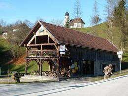
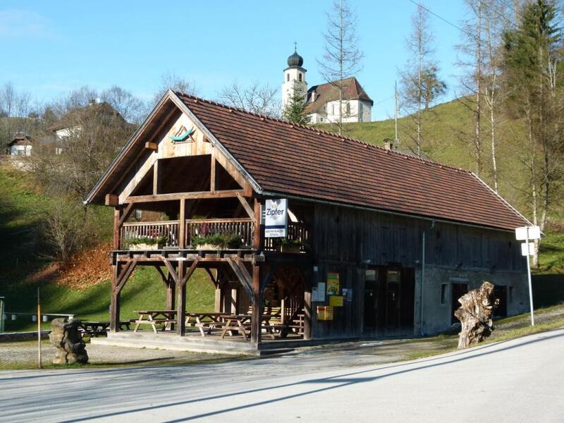
At the start and finish point is the Brunnbachstadl, where regional delicacies and refreshments are served.
Starting point: Großraming/Info hut at Brunnbachstadl
Destination: Großraming/Info hut at Brunnbachstadl
further information:
- Flatly
- Board possible

Jausenstation Brunnbachstadl
Accessibility / arrival
Public Transit
The Ennstalbahn runs between Linz and Weißenbach-St. Gallen.Details at www.ooevv.at
Parking
Großraming/Parking at the Brunnbachstadl
Getting there
From Salzburg/Linz: A1 motorway exit Enns-Steyr > B115 into the Enns Valley
From Vienna: A1 motorway exit Haag > B42 > B122 > B115 into the Enns Valley
From Passau: A8 Passau > Wels > A1 motorway exit Enns-Steyr > B115 into the Enns Valley
From Graz: A9 Pyhrnautobahn > motorway exit Klaus > Grünburg > into the Ennstal Valley
Public Transit
The Ennstalbahn runs between Linz and Weißenbach-St. Gallen.Details at www.ooevv.at
Railway Stations are located in Steyr, Garsten, Lahrndorf, Dürnbach, Ternberg, Trattenbach, Losenstein, Reichraming, Großraming, Gaflenz, Weyer, Küpfern, Kastenreith, Kleinreifling and Weißenbach-St. Gallen.
Parking
Großraming/Parking at the Brunnbachstadl
Most economical season
- Spring
- Summer
- Autumn
- Early winter
- Deep winter
Please get in touch for more information.
Stadtplatz 27
4400 Steyr
Phone +43 7252 53229 - 0
E-Mail info@steyr-nationalpark.at
Web www.steyr-nationalpark.at/
https://www.steyr-nationalpark.at/
Interactive elevation profile
Create PDF
Tour-Details
Starting place: 4463 Großraming
Destination: 4463 Großraming
duration: 0h 39m
length: 2,6 km
Altitude difference (uphill): 25m
Altitude difference (downhill): 25m
Lowest point: 485m
Highest point: 510m
difficulty: easy
condition: easy
panoramic view: Some Views
Paths covering:
Asphalt, Gravel
powered by TOURDATA