TANNERtrail - Rundweg durch das Naturschutzgebiet Tannermoor

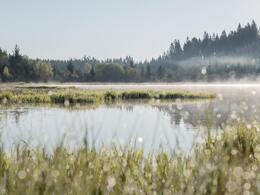
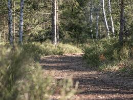
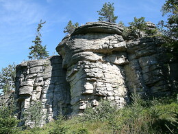
Over the soft ground of the largest continental raised bog in Upper Austria, the path paved with wood chips leads to the high stand, from where you have a view of the entire area of the raised bog. After a refreshing peat footbath, the trail continues along a root path up to the 'Lehrmüller Wall' - a mighty granite hilltop with a magnificent view far into the countryside - before winding its way back to the Rubner pond.
A world of its own opens up to all those interested in nature. Huddled mountain pines, bog bilberries and bilberries line the path and the attentive nature lover may even come across the Fuchtlmandl.
Sturdy, waterproof shoes are advisable.
Information & guided tours on
enquiry: +43 664/73044587
Paths covering:
further information:
- Flatly
- Experience of nature
- Board possible
All year round
Exit Linz, continue on Mühlkreis motorway/A7/E55
exit Mühlkreis motorway/A7/E55, continue on Mühlkreis motorway/A7/E55
turn left onto Mauthausener-Bundesstraße/B123
follow direction: Wartberg Weitersfelden Mauthausen Gutau
turn left onto Mauthausener-Bundesstraße/B123
turn right onto Bahnhofstraße
enter Pregarten, continue on Bahnhofstraße
in Pregarten continue on Stadtplatz
exit Pregarten, continue on Gutauer Straße
turn half left onto Pregartsdorf
continue
turn half right
keep right onto Marktplatz
turn right onto Marktplatz
turn half right
turn left
left turn
half turn left onto Hauptstraße
half turn left
half turn right onto Langfirling
turn right onto Weitersfelden
half turn left onto Nadelbach
half turn right onto Liebenau
- Suitable for groups
- Suitable for kids (all ages)
- Suitable for teenagers
- Suitable for seniors
- Suitable for single travelers
- Suitable for families
- Suitable for friends
- Suitable for couples
- Suitable for children
- Spring
- Summer
- Autumn
Please get in touch for more information.
4252 Liebenau
Phone +43 7953 8111
Fax machine +43 7953 8111 - 30
E-Mail marktgemeinde@liebenau.at
Web www.liebenau.at


