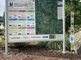
KOBL BIO Round - COUNT IT Bewegungsarena Hagenberg
Path number: H5
Starting place: 4232 Hagenberg im Mühlkreis
Destination: 4232 Hagenberg im Mühlkreis
Kirchenplatz 5a
4232 Hagenberg im Mühlkreis
4232 Hagenberg im Mühlkreis

H5 Kobl Bio Runde: Barrier-free round in a central location.
From the start, the route leads along the main roadin the direction of Salzstraße, where salt was transported to and from Freistadt many years ago. The route continues towards Veichter, past the agricultural education centre and on to the sports area. From there, the route runs along the Softwarepark to the starting point at the Schlosspark.
Path number: H5
Starting place: 4232 Hagenberg im Mühlkreis
Destination: 4232 Hagenberg im Mühlkreis
duration: 0h 45m
length: 4,4 km
Altitude difference (uphill): 37m
Altitude difference (downhill): 29m
Lowest point: 447m
Highest point: 471m
difficulty: medium
condition: medium
panoramic view: Some Views
Paths covering:
Asphalt, Gravel, Hiking trail
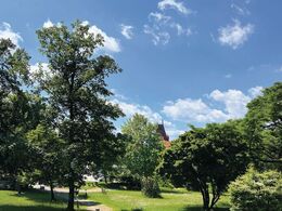
Starting point: Hagenberg Castle Park
Destination: Hagenberg Castle Park
further information:
- Flatly
- Possible accommodation
- Experience of nature
Accessibility / arrival
Coming from Linz:
Follow the A7 motorway in the direction of Freistadt until the Unterweitersdorf exit. Follow the Königswiesener Str./B124 to Hagenberg.
- Free entry
- All weather
- Suitable for groups
- Suitable for single travelers
- Suitable for families
- Suitable for friends
- Suitable for couples
- Spring
- Summer
- Autumn
- Early winter
Suitable for wheelchairs: Not all of the legally stipulated ÖNORM are complied with. In principle, this object is suitable for wheelchairs and no assistance is necessary.
Kirchenplatz 5a
4232 Hagenberg im Mühlkreis
Phone +43 7236 2318
E-Mail gemeinde@hagenberg.ooe.gv.at
Web www.hagenberg.at/bewegungsarena
https://www.hagenberg.at/bewegungsarena


