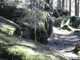
Steinerlebnisweg
Path number: W3
Starting place: 4263 Windhaag bei Freistadt
Destination: 4263 Windhaag bei Freistadt
Stone adventure trail W3 in Windhaag near Freistadt
Market square - cemetery - Riemetschlag - Leithenmühle - Elmberg - Prendt - weather shuttle - Pieberschlag - Windhaag
There you can visit the granite show garden. Then we walk towards Riemetschlag to the Leithenmühle. From the Leithenmühle we continue to the village of Elmberg. In Elmberg and Prendt you can see the various possibilities of granite in house and garden design.
From Prendt we walk along the European watershed and come directly to the weather shuttle, which is located exactly on the European watershed. The hiking trail leads through the watershed sculpture trail, where 19 works of art by the Windhaag sculptor Gerhard Eilmsteiner can be admired. From there we go via the village of Pieberschlag back to Windhaag to the starting point.
Path number: W3
Starting place: 4263 Windhaag bei Freistadt
Destination: 4263 Windhaag bei Freistadt
duration: 2h 33m
length: 9,5 km
Altitude difference (uphill): 124m
Altitude difference (downhill): 132m
Lowest point: 717m
Highest point: 789m
difficulty: medium
condition: medium
panoramic view: Some Views
Paths covering:
Asphalt, Gravel, Street, Hiking trail
Starting point: Market place in Windhaag near Freistadt
Destination: Market place in Windhaag near Freistadt
further information:
- Flatly
- Experience of nature
Accessibility / arrival
by car:
From Nuremberg via Passau-Schärding (Innkreisautobahn A8) and Linz (Mühlkreisautobahn A7).
From Munich and Vienna via the Westautobahn A1 to Linz;
From Linz (Mühlkreisautobahn A7) via Freistadt to Windhaag.
by train:
Via Linz main station to the final stop Freistadt or Summerau
- Free entry
- All weather
- Spring
- Summer
- Autumn
- Early winter
Please get in touch for more information.
Markt 1
4263 Windhaag bei Freistadt
Phone +43 7943 6111
E-Mail tourismus@windhaag-freistadt.ooe.gv.at
Web www.windhaag-freistadt.ooe.gv.at
https://www.windhaag-freistadt.ooe.gv.at


