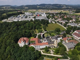
Anitzberg circular route
Path number: Nr. 51
Starting place: 4232 Hagenberg im Mühlkreis
Destination: 4232 Hagenberg im Mühlkreis
The Anitzberg circular trail (51) in Hagenberg im Mühlkreis is a picturesque hiking route that is around 5.1 km long. The route offers a moderate challenge with a difference in altitude of approx. 93 m and can be completed in around 80 minutes.
The route leads through the beautiful landscape of the Mühlviertel and offers numerous opportunities to enjoy nature. The starting point is at the former Dannerwirt inn. The trail leads through forests and along streams, which is particularly refreshing on hot days. Path number: Nr. 51
Starting place: 4232 Hagenberg im Mühlkreis
Destination: 4232 Hagenberg im Mühlkreis
duration: 1h 27m
length: 5,1 km
Altitude difference (uphill): 105m
Altitude difference (downhill): 111m
Lowest point: 383m
Highest point: 487m
difficulty: very easy
condition: very easy
panoramic view: No view
Paths covering:
Asphalt, Hiking trail, Other
Starting point: Hagenberg
Destination: Hagenberg
Most economical season
- Spring
- Summer
- Autumn
Please get in touch for more information.
Kirchenplatz 5a
4232 Hagenberg im Mühlkreis
Phone +43 7236 2318
E-Mail anfrage@muehlviertel.at
Web www.hagenberg.at/
Web www.muehlviertel-urlaub.at/wandern
https://www.hagenberg.at/
https://www.muehlviertel-urlaub.at/wandern
https://www.muehlviertel-urlaub.at/wandern


