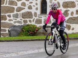
Sterngartl Gusental MTB- Region | Sterngartl-north "Gravel Tour"
Path number: A
Starting place: 4190 Bad Leonfelden
Destination: 4190 Bad Leonfelden
Bad Leonfelden - border Guglwald (CZ) - cycle routes 1033, 1250, 1250A - border Rading / Schwedenschanze (AT) - Reichenthal - Bad Leonfelden.
From Bad Leonfelden past the Sternstein to the Guglwald border (CZ). Follow the markings on cycle routes 1033, 1250, 1250A to the border at Rading / Schwedenschanze (AT). Continue on the historic salt road to just before Bad Leonfelden, in a final round to Reichenthal (mill museum) and back to the starting Point. Path number: A
Starting place: 4190 Bad Leonfelden
Destination: 4190 Bad Leonfelden
duration: 5h 45m
length: 71,0 km
Altitude difference (uphill): 1.311m
Altitude difference (downhill): 1.315m
Lowest point: 627m
Highest point: 1.023m
difficulty: difficult
condition: difficult
panoramic view: Great panorama
Paths covering:
Asphalt, Gravel, Other
Starting point: 4190 Bad Leonfelden, Kastner car park
Destination: 4190 Bad Leonfelden, Kastner car park
further information:
- Flatly
Parking
- Parking space: 20
- Bus parking space: 2
- Suitable for groups
- Suitable for teenagers
- Suitable for seniors
- Suitable for single travelers
- Spring
- Summer
- Autumn
Please get in touch for more information.
Ringstraße 77
4190 Bad Leonfelden
Phone +43 7213 20930
E-Mail office@sterngartl-gusental.at
Web www.sterngartl-gusental-leader.at
http://www.sterngartl-gusental-leader.at
powered by TOURDATA


