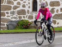
GrenzenLosRadel-Tour "Gravel Tour"
BorderLessBiking
This cross-border circular tour starts and ends in the charming spa town of Bad Leonfelden and takes you 61.3 km through the gently undulating landscape of the Mühlviertel to the neighboring Czech Republic. With around 924 m of ascent and a riding time of around 6 ½ hours, the route is ideal for sporty leisure cyclists in good physical condition.
The route is varied on asphalt, gravel paths and small side roads and offers fantastic views of the forests, meadows and villages in the region. Highlights are the crossing of the border at Rading (Schwedenschanze) to Raifmass (former village in the Bohemian Forest), the passage through the Czech Bohemian Forest towards Mlýnek, after approx. 11 km turn left towards Dolní Drkolná, Herbertov and Vyšší Brod. On the north bank along the Vltava with a detour to Lipno, you cross over to the south bank along the beautiful Vltava reservoir until you reach the village of Přední Výtoň. Turn left here towards the border crossing. The return follows via Guglwald, Schönegg through the Sternwald forest, past the wind farm towards Waldschenke. From there via Amesberg, Unterlaimbach back to the town. Historic places, quiet forest passages and wide panoramas make this tour a real experience.
A must for all those who want to discover the Mühlviertel in all its diversity - with a touch of international flair.
- Spring
- Summer
- Autumn
Please get in touch for more information.
Hauptplatz 19
4190 Bad Leonfelden
Phone +43 5 07263 - 101
E-Mail badleonfelden@muehlviertel.at
Web www.muehlviertel.at


